Show the map
OFFICIAL ROUTE
Méribel Trail 2017- 23 km
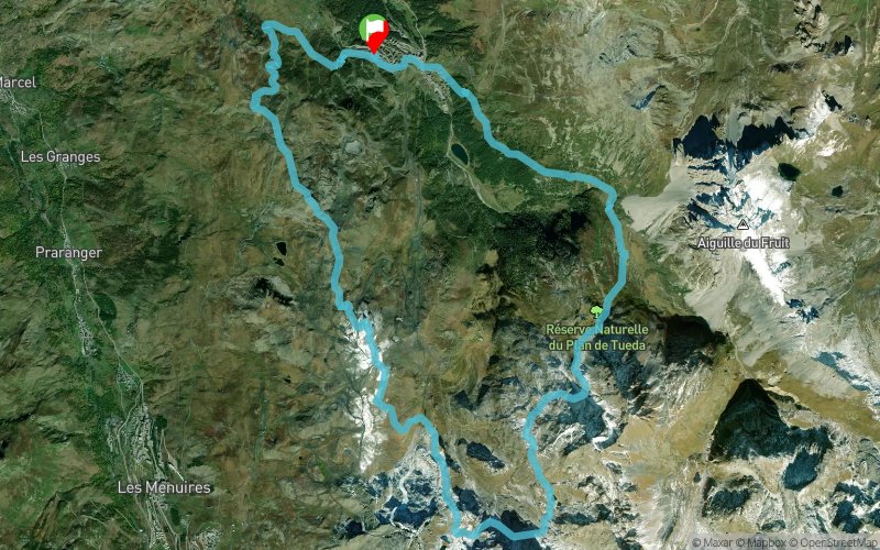


24.1 km
1584 m
1591 m
 meribel mottaret (73)
 meribel mottaret ()
 9
9 Points of Interest table
| Accum. | Intermediary | |||||||
|---|---|---|---|---|---|---|---|---|
| POI | Description | Alt. | Dist. | D+ | D- | Dist. | D+ | D- |
 Competition organized on 08/13/2017
Trace n°24850
Ascent threshold : 3 m Distance threshold : 0 m Smoothing : No Origin of altitudes : GPS
Ascent threshold : 3 m Distance threshold : 0 m Smoothing : No Origin of altitudes : GPS
Crossing
Dominant terrain : Footpath
Max alti. : 2467 m
Avg alti. : 2073 m
Min alti. : 1687 m
Longest ascent : 960 m
Longest descent : 910 m
Dominant terrain : Footpath
Max alti. : 2467 m
Avg alti. : 2073 m
Min alti. : 1687 m
Longest ascent : 960 m
Longest descent : 910 m
Elevation profile
More tools
Create a new roadbook page
Map and track on your website
Warning ! When you insert a Trace de Trail map on your website, you agree not to hide any element of the module (links to Trail Trail or Trail Connect banner)
Add a realisation
Validate
Add a comment
Validate
Show the infos
Add a track


