Show the map
OFFICIAL ROUTE
Oürea Trail 2021 - Étape 5 / Oürea Solo 5 - 49 km


48.5 km
2970 m
2970 m
 Les Crosets (CH)
Date: Thursday 29 July 2021, Start: Mass wave start, Start time: 07:00 hrs, Ascent: 3,340m, Descent: 3,340m
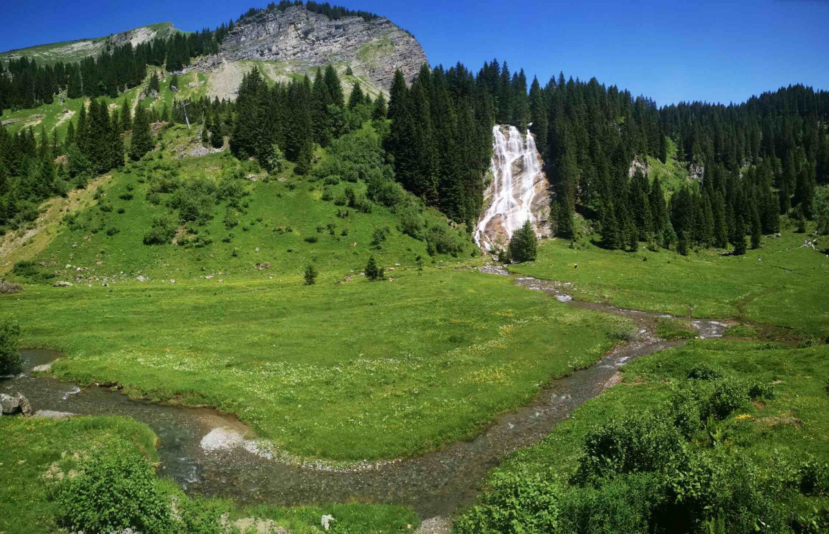
After a downhill start, you’ll pass in front of the fabulous Brochaux waterfall to climb up to the Col de Chesery and its refuge. For the 2nd time in one week, you’ll make an incursion into Switzerland. Next, you’ll head along Vert Lake to the famous pass at the Portes du Soleil. There you’ll run along a ridge leading to the Pointe de l’Au for 5km as far as the Pointe Savolaire before diving down to Morgins. From there you’ll attack the climb up to Le Morclan overhanging Châtel, which will welcome you with an aid station. The return to Avoriaz will take in the base of the Morgins valley leading to the Chesery refuge, then the GR5 up to the Rochassons ridge before dropping down to Lindarets and making one last climb up to Avoriaz.
Using the chairlifts from Avoriaz, spectators will be able to cheer on the trail runners at 2 hotspots:
To get to the 7km point: Take the chairlifts at Lindarets, Léchère and Mossettes
To get to the 43km point: Take the chairlifts at Mossettes, Léchère and Chaux Fleurie
To get to the 46km point: Get back on the Chaux Fleurie chairlift.
Points of Interest table
| Accum. | Intermediary | |||||||
|---|---|---|---|---|---|---|---|---|
| POI | Description | Alt. | Dist. | D+ | D- | Dist. | D+ | D- |
 Competition organized on 07/29/2021
Trace n°92346
Ascent threshold : 3 m Distance threshold : 30 m Smoothing : Yes Origin of altitudes : MNT IGN
Ascent threshold : 3 m Distance threshold : 30 m Smoothing : Yes Origin of altitudes : MNT IGN
Loop
Dominant terrain : Footpath
Max alti. : 2130 m
Avg alti. : 1689 m
Min alti. : 1209 m
Longest ascent : 550 m
Longest descent : 870 m
Dominant terrain : Footpath
Max alti. : 2130 m
Avg alti. : 1689 m
Min alti. : 1209 m
Longest ascent : 550 m
Longest descent : 870 m
Elevation profile
More tools
Create a new roadbook page
Map and track on your website
Warning ! When you insert a Trace de Trail map on your website, you agree not to hide any element of the module (links to Trail Trail or Trail Connect banner)
Add a realisation
Validate
Add a realisation to share your chrono and describe the conditions that you encountered during you trail running !
Add a comment
Validate
Show the infos
Add a track


