Show the map
Col de Malval - Barmont - Châtelard - Col de la Fausse
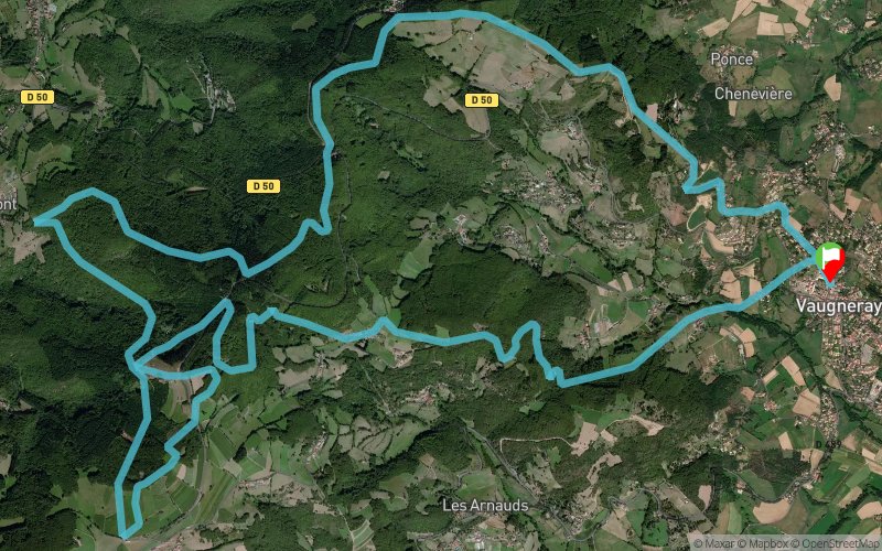


21.3 km
980 m
980 m
 Vaugneray (69)
 Points of Interest table
| Accum. | Intermediary | |||||||
|---|---|---|---|---|---|---|---|---|
| POI | Description | Alt. | Dist. | D+ | D- | Dist. | D+ | D- |
Trace n°90775
Ascent threshold : 3 m Distance threshold : 30 m Smoothing : No Origin of altitudes : MNT Aster GDEM
Ascent threshold : 3 m Distance threshold : 30 m Smoothing : No Origin of altitudes : MNT Aster GDEM
Loop
Dominant terrain : Footpath
Max alti. : 893 m
Avg alti. : 702 m
Min alti. : 392 m
Longest ascent : 350 m
Longest descent : 510 m
Route completed by the author : Yes
Dominant terrain : Footpath
Max alti. : 893 m
Avg alti. : 702 m
Min alti. : 392 m
Longest ascent : 350 m
Longest descent : 510 m
Route completed by the author : Yes
Elevation profile
More tools
Create a new roadbook page
Map and track on your website
Warning ! When you insert a Trace de Trail map on your website, you agree not to hide any element of the module (links to Trail Trail or Trail Connect banner)
Add a realisation
Validate
Add a realisation to share your chrono and describe the conditions that you encountered during you trail running !
Add a comment
Validate
papy-trail
30/05/22, 21:31:37
Trop peu de points donc tracé imprécis et risque d'erreurs de parcours dommage car la boucle sympa. Mieux vaut la retracer et peut être la faire dans le sens horaire vu le profil et l'état des chemins.
30/05/22, 21:31:37
Trop peu de points donc tracé imprécis et risque d'erreurs de parcours dommage car la boucle sympa. Mieux vaut la retracer et peut être la faire dans le sens horaire vu le profil et l'état des chemins.
Show the infos
Add a track


