Show the map
Pioch Michel - Pioch Noir
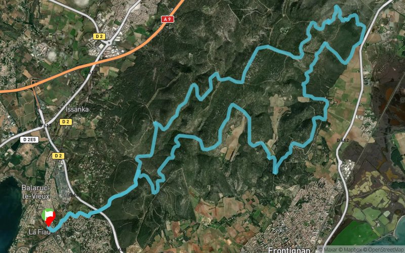


28.7 km
754 m
753 m
 Balaruc-le-Vieux (34)
 Points of Interest table
| Accum. | Intermediary | |||||||
|---|---|---|---|---|---|---|---|---|
| POI | Description | Alt. | Dist. | D+ | D- | Dist. | D+ | D- |
Trace n°8463
Ascent threshold : 3 m Distance threshold : 30 m Smoothing : Yes Origin of altitudes : MNT Aster GDEM
Ascent threshold : 3 m Distance threshold : 30 m Smoothing : Yes Origin of altitudes : MNT Aster GDEM
Loop
Dominant terrain : Path
Max alti. : 226 m
Avg alti. : 106 m
Min alti. : 4 m
Longest ascent : 251 m
Longest descent : 177 m
Route completed by the author : nc
Dominant terrain : Path
Max alti. : 226 m
Avg alti. : 106 m
Min alti. : 4 m
Longest ascent : 251 m
Longest descent : 177 m
Route completed by the author : nc
Elevation profile
More tools
Create a new roadbook page
Map and track on your website
Warning ! When you insert a Trace de Trail map on your website, you agree not to hide any element of the module (links to Trail Trail or Trail Connect banner)
Add a realisation
Validate
Add a realisation to share your chrono and describe the conditions that you encountered during you trail running !
Add a comment
Validate
Micaël Bricaud
05/08/19, 20:27:46
Fait le 4/8/19 au petit matin. Trace assez simple à suivre. Beau paysage. Rencontre d'un sanglier.
05/08/19, 20:27:46
Fait le 4/8/19 au petit matin. Trace assez simple à suivre. Beau paysage. Rencontre d'un sanglier.
Show the infos
Add a track


