Show the map
Traversée rando du Jura
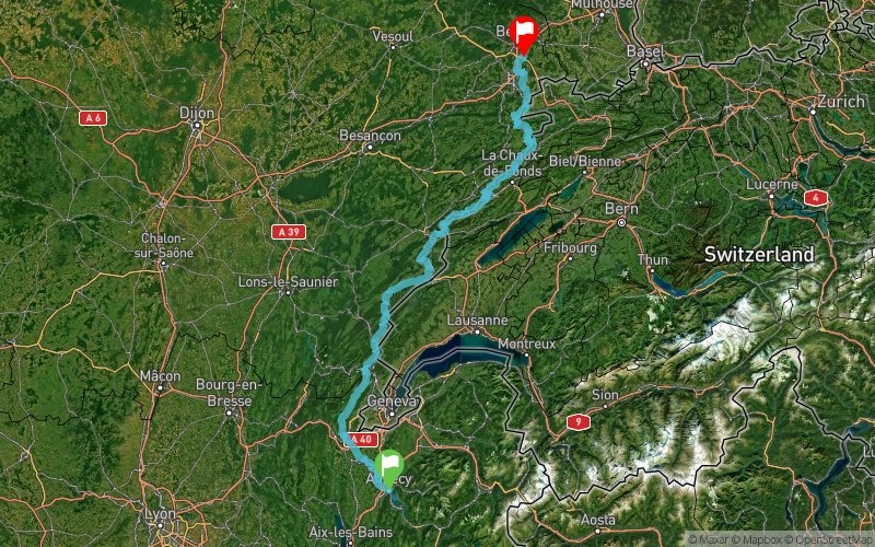


368.3 km
24810 m
24900 m
 Annecy (74)
 Moval (90)
 Points of Interest table
| Accum. | Intermediary | |||||||
|---|---|---|---|---|---|---|---|---|
| POI | Description | Alt. | Dist. | D+ | D- | Dist. | D+ | D- |
Trace n°83035
Ascent threshold : 0 m Distance threshold : 0 m Smoothing : No Origin of altitudes : MNT Aster GDEM
Ascent threshold : 0 m Distance threshold : 0 m Smoothing : No Origin of altitudes : MNT Aster GDEM
Crossing
Dominant terrain : Footpath
Max alti. : 1739 m
Avg alti. : 915 m
Min alti. : 314 m
Longest ascent : 1400 m
Longest descent : 830 m
Route completed by the author : No
Dominant terrain : Footpath
Max alti. : 1739 m
Avg alti. : 915 m
Min alti. : 314 m
Longest ascent : 1400 m
Longest descent : 830 m
Route completed by the author : No
Elevation profile
More tools
Create a new roadbook page
Map and track on your website
Warning ! When you insert a Trace de Trail map on your website, you agree not to hide any element of the module (links to Trail Trail or Trail Connect banner)
Add a realisation
Validate
Add a realisation to share your chrono and describe the conditions that you encountered during you trail running !
Add a comment
Validate
Admin - Trace de Trail
28/03/19, 21:10:00
Bonjour, Votre trace n'est pas de qualité suffisante pour être maintenue en public (pas assez de points). De plus, vous ne respectez pas les règles de nommage du site https://tracedetrail.com/fr/accueil/help/alire. Merci de corriger tout cela :-)
28/03/19, 21:10:00
Bonjour, Votre trace n'est pas de qualité suffisante pour être maintenue en public (pas assez de points). De plus, vous ne respectez pas les règles de nommage du site https://tracedetrail.com/fr/accueil/help/alire. Merci de corriger tout cela :-)
Show the infos
Add a track


