Show the map
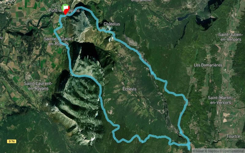
Montagne de l'Arp - Les Barques en Vercors - Pas de l'Allier - Pont en Royans


27.7 km
1900 m
1900 m

Points of Interest table
Accum. | Intermediary | |||||||
---|---|---|---|---|---|---|---|---|
POI | Description | Alt. | Dist. | D+ | D- | Dist. | D+ | D- |
Trace n°81968
Ascent threshold : 3 m Distance threshold : 30 m Smoothing : Yes Origin of altitudes : MNT Aster GDEM
Loop
Dominant terrain : Footpath
Max alti. : 1313 m
Avg alti. : 813 m
Min alti. : 192 m
Longest ascent : 930 m
Longest descent : 1070 m
Route completed by the author : Yes
Dominant terrain : Footpath
Max alti. : 1313 m
Avg alti. : 813 m
Min alti. : 192 m
Longest ascent : 930 m
Longest descent : 1070 m
Route completed by the author : Yes
Elevation profile

Their last tracks
Bois de Pierre - Bois de Chevrières - Croix de Mouze - La Buissonnière
18.9 km
620 m
620 m
Murinais (38)
Forêt des Coulmes - Col du Mont Noir - La Goulandière - Plan du Faz
23.8 km
1070 m
1070 m
Saint-Pierre-de-Chérennes (38)
Rocher de l'Alevoux - Le Faz - Serre Cocu - St-André-en-Royans
30.3 km
1130 m
1130 m
Saint-Romans (38)
More tools
Create a new roadbook page
Carte à la Carte IGN
Map and track on your website
Warning ! When you insert a Trace de Trail map on your website, you agree not to hide any element of the module (links to Trail Trail or Trail Connect banner)
Add a realisation
Validate
Add a realisation to share your chrono and describe the conditions that you encountered during you trail running !
Add a comment
Validate
Nearby tracks
4.1 km Combe de Vialonge - Serre Cocu - Scialet des Blaches - Col de Toutes Aures
15.7 km
970 m
970 m
Saint-André-en-Royans (38)
4.2 km Courtevoux - Pont-en-Royans - Balai - La Guibaudière
12.6 km
460 m
460 m
Saint-André-en-Royans (38)
Show the infos
Add a track