Show the map
Certified Track - ITRA
Llanganuco Mountain Trail 2019 - 30K
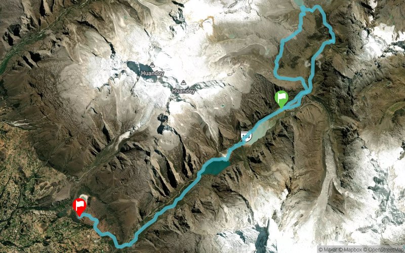


30.2 km
1240 m
1590 m
 Unknown (ND)
 Unknown (ND)
 6
6 Points of Interest table
| Accum. | Intermediary | |||||||
|---|---|---|---|---|---|---|---|---|
| POI | Description | Alt. | Dist. | D+ | D- | Dist. | D+ | D- |
 Competition organized on 07/20/2019
Trace n°72024
Ascent threshold : 3 m Distance threshold : 0 m Smoothing : No Origin of altitudes : GPS
Ascent threshold : 3 m Distance threshold : 0 m Smoothing : No Origin of altitudes : GPS
Crossing
Dominant terrain : Footpath
Max alti. : 4883 m
Avg alti. : 4091 m
Min alti. : 3429 m
Longest ascent : 1070 m
Longest descent : 1520 m
Dominant terrain : Footpath
Max alti. : 4883 m
Avg alti. : 4091 m
Min alti. : 3429 m
Longest ascent : 1070 m
Longest descent : 1520 m
Elevation profile
More tools
Create a new roadbook page
Map and track on your website
Warning ! When you insert a Trace de Trail map on your website, you agree not to hide any element of the module (links to Trail Trail or Trail Connect banner)
Add a realisation
Validate
Add a realisation to share your chrono and describe the conditions that you encountered during you trail running !
Add a comment
Validate
Admin - Trace de Trail
07/11/18, 21:18:01
Bonjour, Merci de ne laisser en public qu'une seule trace pour une même épreuve (sauf replis)
07/11/18, 21:18:01
Bonjour, Merci de ne laisser en public qu'une seule trace pour une même épreuve (sauf replis)
Show the infos
Add a track


