Show the map
Evaluated Track - ITRA
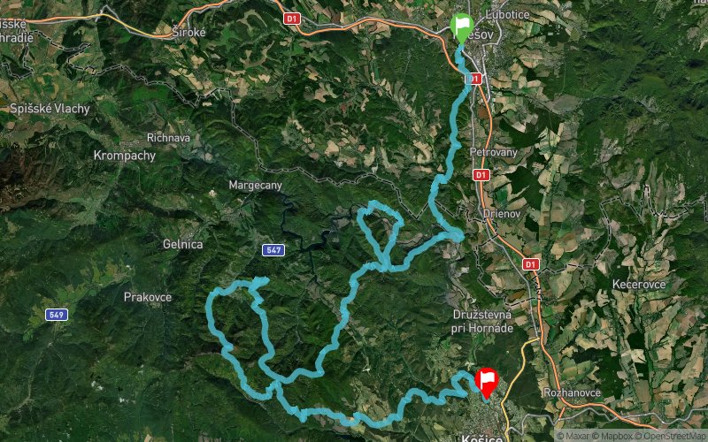
Vychodniarska Stovka 2018


 Vysiela? (SK)
 Staré Mesto (SK)


Východniarska stovka is approximately 129 km continuous point to point ultra trail race for individuals and relay teams. The course connects Košice and Prešov, two of the biggest cities in the east part of Slovakia – and for a majority of the race follows Volovské vrchy: a very beautiful part of the „Slovenské rudohorie“ mountain range.
Points of Interest table
| Accum. | Intermediary | |||||||
|---|---|---|---|---|---|---|---|---|
| POI | Description | Alt. | Dist. | D+ | D- | Dist. | D+ | D- |
 Competition organized on 08/04/2018
Trace n°60079
Ascent threshold : 3 m Distance threshold : 30 m Smoothing : Yes Origin of altitudes : MNT Google
Ascent threshold : 3 m Distance threshold : 30 m Smoothing : Yes Origin of altitudes : MNT Google
Crossing
Dominant terrain : Footpath
Max alti. : 1236 m
Avg alti. : 574 m
Min alti. : 209 m
Longest ascent : 540 m
Longest descent : 630 m
Dominant terrain : Footpath
Max alti. : 1236 m
Avg alti. : 574 m
Min alti. : 209 m
Longest ascent : 540 m
Longest descent : 630 m
Elevation profile
More tools
Create a new roadbook page
Map and track on your website
Warning ! When you insert a Trace de Trail map on your website, you agree not to hide any element of the module (links to Trail Trail or Trail Connect banner)
Add a realisation
Validate
Add a realisation to share your chrono and describe the conditions that you encountered during you trail running !
Add a comment
Validate
Show the infos
Add a track


