Show the map
Cerros da Carrapateira
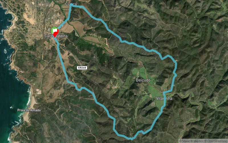


13.2 km
330 m
330 m
 Carrapateira (PT)
 Points of Interest table
| Accum. | Intermediary | |||||||
|---|---|---|---|---|---|---|---|---|
| POI | Description | Alt. | Dist. | D+ | D- | Dist. | D+ | D- |
Trace n°59262
Ascent threshold : 3 m Distance threshold : 30 m Smoothing : Yes Origin of altitudes : MNT Aster GDEM
Ascent threshold : 3 m Distance threshold : 30 m Smoothing : Yes Origin of altitudes : MNT Aster GDEM
Loop
Dominant terrain : Footpath
Max alti. : 131 m
Avg alti. : 71 m
Min alti. : 7 m
Longest ascent : 140 m
Longest descent : 110 m
Route completed by the author : nc
Dominant terrain : Footpath
Max alti. : 131 m
Avg alti. : 71 m
Min alti. : 7 m
Longest ascent : 140 m
Longest descent : 110 m
Route completed by the author : nc
Elevation profile
More tools
Create a new roadbook page
Map and track on your website
Warning ! When you insert a Trace de Trail map on your website, you agree not to hide any element of the module (links to Trail Trail or Trail Connect banner)
Add a realisation
Validate
Add a realisation to share your chrono and describe the conditions that you encountered during you trail running !
Add a comment
Validate
Admin - Trace de Trail
19/05/18, 17:48:30
Bonjour, Merci de respecter les règles de nommage du site : https://tracedetrail.fr/fr/accueil/help/alire
19/05/18, 17:48:30
Bonjour, Merci de respecter les règles de nommage du site : https://tracedetrail.fr/fr/accueil/help/alire
Show the infos
Add a track


