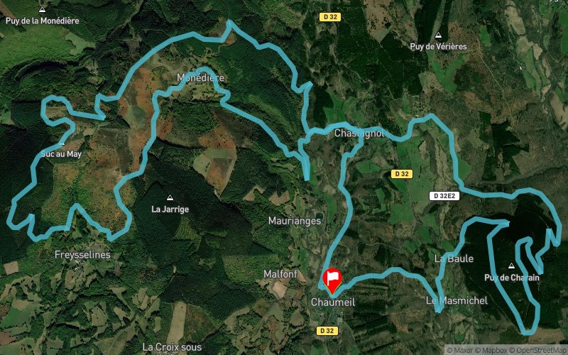
Show the map
Saramagbelle Myrtilles Trail VTT 2018 - Le Tréphy - 29 km


28.9 km
1230 m
1230 m
 Chaumeil (19)
 Chaumeil (19)
 Points of Interest table
| Accum. | Intermediary | |||||||
|---|---|---|---|---|---|---|---|---|
| POI | Description | Alt. | Dist. | D+ | D- | Dist. | D+ | D- |
 Competition organized on 05/27/2018
Trace n°58769
Ascent threshold : 7 m Distance threshold : 30 m Smoothing : Yes Origin of altitudes : MNT Aster GDEM
Ascent threshold : 7 m Distance threshold : 30 m Smoothing : Yes Origin of altitudes : MNT Aster GDEM
Loop
Dominant terrain : Footpath
Max alti. : 899 m
Avg alti. : 755 m
Min alti. : 604 m
Longest ascent : 230 m
Longest descent : 240 m
Dominant terrain : Footpath
Max alti. : 899 m
Avg alti. : 755 m
Min alti. : 604 m
Longest ascent : 230 m
Longest descent : 240 m
More tools
Create a new roadbook page
Map and track on your website
Warning ! When you insert a Trace de Trail map on your website, you agree not to hide any element of the module (links to Trail Trail or Trail Connect banner)
Add a realisation
Validate
Add a realisation to share your chrono and describe the conditions that you encountered during you trail running !
Add a comment
Validate
Admin - Trace de Trail
19/12/18, 20:39:52
Bonjour, Merci de corriger votre date de compétition si vous voulez utiliser cette trace pour 2019...
19/12/18, 20:39:52
Bonjour, Merci de corriger votre date de compétition si vous voulez utiliser cette trace pour 2019...
Show the infos
Add a track


