Show the map
Certified Track - ITRA
Trail de la Tieule 2018
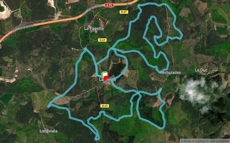


 La Tieule (48)

A little track to unwind, trails, singles and off-piste for fun. Climbs for toxins, descent to recover. All in the wild landscapes of La Lozère and Sauveterre.
Points of Interest table
| Accum. | Intermediary | |||||||
|---|---|---|---|---|---|---|---|---|
| POI | Description | Alt. | Dist. | D+ | D- | Dist. | D+ | D- |
 Competition organized on 05/27/2018
Trace n°58124
Ascent threshold : 0 m Distance threshold : 30 m Smoothing : Yes Origin of altitudes : MNT IGN
Ascent threshold : 0 m Distance threshold : 30 m Smoothing : Yes Origin of altitudes : MNT IGN
Loop
Dominant terrain : Footpath
Max alti. : 1013 m
Avg alti. : 894 m
Min alti. : 796 m
Longest ascent : 120 m
Longest descent : 150 m
Dominant terrain : Footpath
Max alti. : 1013 m
Avg alti. : 894 m
Min alti. : 796 m
Longest ascent : 120 m
Longest descent : 150 m
Elevation profile
More tools
Create a new roadbook page
Map and track on your website
Warning ! When you insert a Trace de Trail map on your website, you agree not to hide any element of the module (links to Trail Trail or Trail Connect banner)
Add a realisation
Validate
Add a realisation to share your chrono and describe the conditions that you encountered during you trail running !
Add a comment
Validate
Show the infos
Add a track


