Show the map
Bois de la Gressée - Journy - Westbécourt
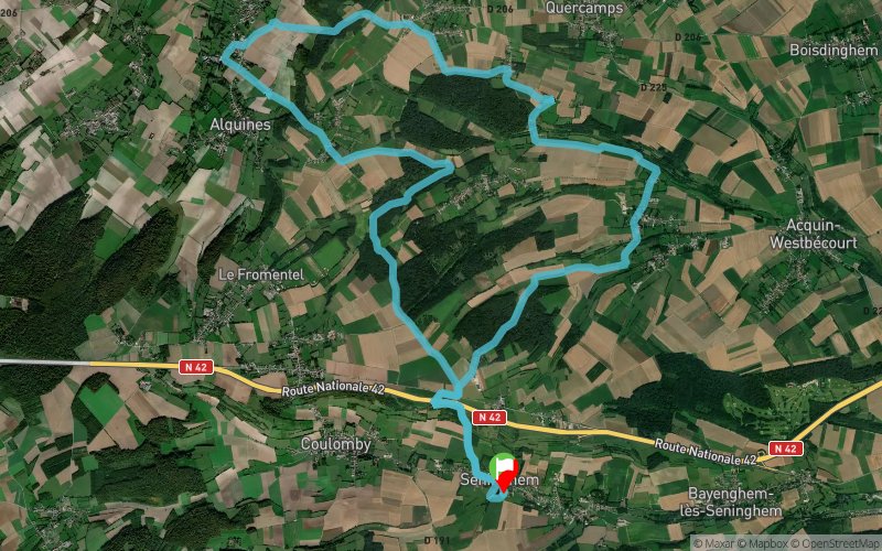


22.9 km
521 m
517 m
 Seninghem (62)
 Points of Interest table
| Accum. | Intermediary | |||||||
|---|---|---|---|---|---|---|---|---|
| POI | Description | Alt. | Dist. | D+ | D- | Dist. | D+ | D- |
Trace n°5625
Ascent threshold : 3 m Distance threshold : 30 m Smoothing : Yes Origin of altitudes : MNT Aster GDEM
Ascent threshold : 3 m Distance threshold : 30 m Smoothing : Yes Origin of altitudes : MNT Aster GDEM
Loop
Dominant terrain : Footpath
Max alti. : 212 m
Avg alti. : 143 m
Min alti. : 75 m
Longest ascent : 122 m
Longest descent : 117 m
Route completed by the author : nc
Dominant terrain : Footpath
Max alti. : 212 m
Avg alti. : 143 m
Min alti. : 75 m
Longest ascent : 122 m
Longest descent : 117 m
Route completed by the author : nc
Elevation profile
More tools
Create a new roadbook page
Map and track on your website
Warning ! When you insert a Trace de Trail map on your website, you agree not to hide any element of the module (links to Trail Trail or Trail Connect banner)
Add a realisation
Validate
Add a realisation to share your chrono and describe the conditions that you encountered during you trail running !
Add a comment
Validate
samu2000
15/05/15, 13:22:04
Attention au balisage au 16 ème km passage dans un espace type fossé mais pas de signalisation Sinon parcours sympa à faire, quelques bons passages techniques en descente
15/05/15, 13:22:04
Attention au balisage au 16 ème km passage dans un espace type fossé mais pas de signalisation Sinon parcours sympa à faire, quelques bons passages techniques en descente
Show the infos
Add a track


