Show the map
Evaluated Track - ITRA
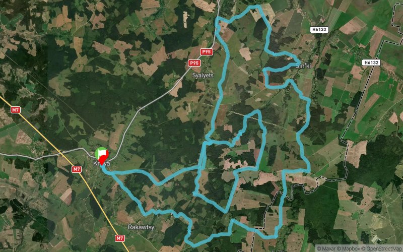
Juk-Trail # 5 Krevo 2018 - Juk-Trail 70 km


 ????? (BY)


The adventure race federation invites you to participate in a running or cycling marathon "Zhuk-trail #5 Krevo" on the 15th April 2018.
The start and finish line will be located by the remains of Krebo castle; the organisational centre of the race will be located in the school 500m away from the start line.
The runners can choose between 4 distances (11, 25, 45 and 75 km). There are 2 distances for cyclists (45 and 70 km). All routes are marked along the trailways and field roads. There are several feeding stations (tea, biscuits, fruits).
There will be electronic system of time control.
Along the way the participants will see the historical and natural sights: Krevo castle, mills near Krevo village, the fragment of old path between Losk and Smorgon, tatar township Dovbuchki, bowlder "Feline stone", the remains of Transfiguration church in Novospassk village, fortification line World War I, Milidowski Hill, clay pits, remains of the brickyards, hills and canyons, forests of Zakrevye etc.
Kids and supporters will have a chance to run a short "fun race" for free.
Participants of "trail 70" which starts at 8am can stay in the school building the night before the race.
Registration fees before 10th April are 20 BLR for 11/25km, and 25 BLR for 45/70km running or cycling. Registration on the day of the race will be more expensive.
All information is available on the website of Adventure Race Federation https://www.arf.by/
Points of Interest table
| Accum. | Intermediary | |||||||
|---|---|---|---|---|---|---|---|---|
| POI | Description | Alt. | Dist. | D+ | D- | Dist. | D+ | D- |
 Competition organized on 04/15/2018
Trace n°56122
Ascent threshold : 3 m Distance threshold : 30 m Smoothing : Yes Origin of altitudes : MNT Google
Ascent threshold : 3 m Distance threshold : 30 m Smoothing : Yes Origin of altitudes : MNT Google
Loop
Dominant terrain : Road
Max alti. : 310 m
Avg alti. : 254 m
Min alti. : 175 m
Longest ascent : 140 m
Longest descent : 80 m
Dominant terrain : Road
Max alti. : 310 m
Avg alti. : 254 m
Min alti. : 175 m
Longest ascent : 140 m
Longest descent : 80 m
Elevation profile
More tools
Create a new roadbook page
Map and track on your website
Warning ! When you insert a Trace de Trail map on your website, you agree not to hide any element of the module (links to Trail Trail or Trail Connect banner)
Add a realisation
Validate
Add a realisation to share your chrono and describe the conditions that you encountered during you trail running !
Add a comment
Validate
Show the infos
Add a track


