Show the map
La Garonne - La Frégate - Bois des Jésuites
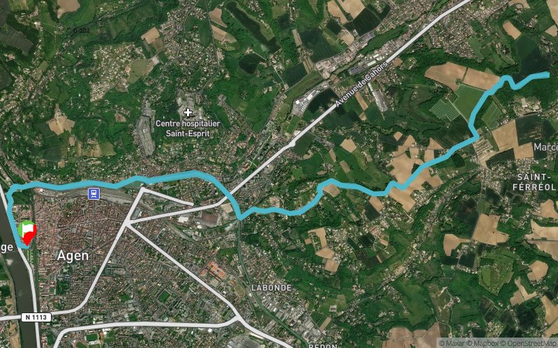


18.8 km
330 m
330 m
 Le Passage (47)
 Points of Interest table
| Accum. | Intermediary | |||||||
|---|---|---|---|---|---|---|---|---|
| POI | Description | Alt. | Dist. | D+ | D- | Dist. | D+ | D- |
Trace n°56088
Ascent threshold : 3 m Distance threshold : 30 m Smoothing : Yes Origin of altitudes : MNT Aster GDEM
Ascent threshold : 3 m Distance threshold : 30 m Smoothing : Yes Origin of altitudes : MNT Aster GDEM
Loop
Dominant terrain : Path
Max alti. : 172 m
Avg alti. : 95 m
Min alti. : 25 m
Longest ascent : 140 m
Longest descent : 150 m
Route completed by the author : nc
Dominant terrain : Path
Max alti. : 172 m
Avg alti. : 95 m
Min alti. : 25 m
Longest ascent : 140 m
Longest descent : 150 m
Route completed by the author : nc
Elevation profile
More tools
Create a new roadbook page
Map and track on your website
Warning ! When you insert a Trace de Trail map on your website, you agree not to hide any element of the module (links to Trail Trail or Trail Connect banner)
Add a realisation
Validate
Add a realisation to share your chrono and describe the conditions that you encountered during you trail running !
Add a comment
Validate
jojole47
05/04/18, 10:40:01
Vraiment une bonne session. Pas de prise de risque niveau vitesse et au final à l'arrivée pas de douleur horrible comme à chaque fois lors de mes grosses sorties. Du kiff !!! :-)
05/04/18, 10:40:01
Vraiment une bonne session. Pas de prise de risque niveau vitesse et au final à l'arrivée pas de douleur horrible comme à chaque fois lors de mes grosses sorties. Du kiff !!! :-)
Show the infos
Add a track


