Show the map
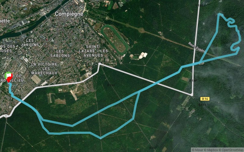
Résidence du parc - mont tremble - Beaux monts


18.3 km
270 m
270 m

Points of Interest table
Accum. | Intermediary | |||||||
---|---|---|---|---|---|---|---|---|
POI | Description | Alt. | Dist. | D+ | D- | Dist. | D+ | D- |
Trace n°54238
Ascent threshold : 3 m Distance threshold : 30 m Smoothing : Yes Origin of altitudes : MNT Aster GDEM
Loop
Dominant terrain : Path
Max alti. : 141 m
Avg alti. : 65 m
Min alti. : 32 m
Longest ascent : 100 m
Longest descent : 100 m
Route completed by the author : nc
Dominant terrain : Path
Max alti. : 141 m
Avg alti. : 65 m
Min alti. : 32 m
Longest ascent : 100 m
Longest descent : 100 m
Route completed by the author : nc
Elevation profile

Their last tracks
Dent de Cons - Pointe de Chaurionde - Mont Pécloz - Mont Colombier - Mont Trélod
96.6 km
9170 m
9160 m
Val de Chaise (74)
Porte d'hennemont - Forêt de Marly-le-Roi - Forêt des Tailles d'Herbelay
52.9 km
1170 m
1170 m
Poissy (78)
Étang du Corra - Forêt de St-Germain-en-Laye - Parc de Maisons-Laffitte
32.5 km
480 m
480 m
Poissy (78)
More tools
Create a new roadbook page
Carte à la Carte IGN
Map and track on your website
Warning ! When you insert a Trace de Trail map on your website, you agree not to hide any element of the module (links to Trail Trail or Trail Connect banner)
Add a realisation
Validate
Add a realisation to share your chrono and describe the conditions that you encountered during you trail running !
Add a comment
Validate
Nearby tracks
14.6 km Forêt de Compiègne - Le Clos Michel - Maison Forestière de St-Nicolas de Courson
10.3 km
110 m
110 m
Saint-Jean-aux-Bois (60)
16.7 km Forêt de Compiègne - Le Clos Michel - Carrefour de la Tête St-Jean
12.1 km
430 m
490 m
Saint-Jean-aux-Bois (60)
Show the infos
Add a track