Show the map
Certified Track - ITRA
Perimetral de Javalambre 2018
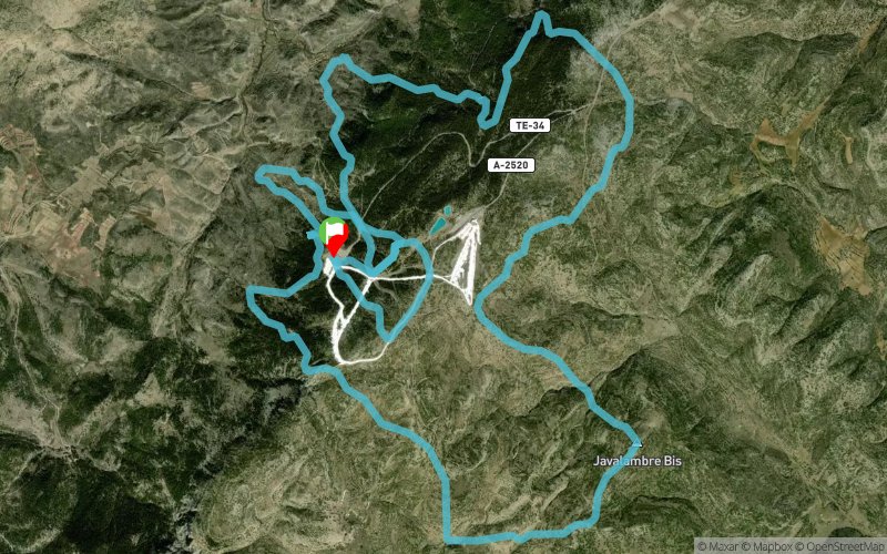


27 km
2220 m
2220 m
 Camarena De La Sierra (ES)
 10
10 250
250 Points of Interest table
| Accum. | Intermediary | |||||||
|---|---|---|---|---|---|---|---|---|
| POI | Description | Alt. | Dist. | D+ | D- | Dist. | D+ | D- |
 Competition organized on 06/09/2018
Trace n°54229
Ascent threshold : 3 m Distance threshold : 0 m Smoothing : No Origin of altitudes : GPS
Ascent threshold : 3 m Distance threshold : 0 m Smoothing : No Origin of altitudes : GPS
Loop
Dominant terrain : Path
Max alti. : 2013 m
Avg alti. : 1758 m
Min alti. : 1367 m
Longest ascent : 440 m
Longest descent : 580 m
Dominant terrain : Path
Max alti. : 2013 m
Avg alti. : 1758 m
Min alti. : 1367 m
Longest ascent : 440 m
Longest descent : 580 m
Elevation profile
More tools
Create a new roadbook page
Map and track on your website
Warning ! When you insert a Trace de Trail map on your website, you agree not to hide any element of the module (links to Trail Trail or Trail Connect banner)
Add a realisation
Validate
Add a realisation to share your chrono and describe the conditions that you encountered during you trail running !
Add a comment
Validate
Admin - Trace de Trail
07/03/18, 19:15:13
Bonjour, merci de renommer votre trace de manière à ce que la compétition puisse facilement être identifiée avant de la placer en publique : https://tracedetrail.fr/fr/accueil/help/alire
07/03/18, 19:15:13
Bonjour, merci de renommer votre trace de manière à ce que la compétition puisse facilement être identifiée avant de la placer en publique : https://tracedetrail.fr/fr/accueil/help/alire
Show the infos
Add a track


