Show the map
Evaluated Track - ITRA
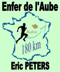
Enfer de l'Aube Eric Peters 2018


 Troyes (10)


L'Enfer de l'Aube Éric Peters Ultra trail of 180 km
In duet 90 km or 180 km
No particular difficulty except the distance
The vertical drop is about 3000 D + on paths and forest
8 well food supplies, volunteers will bring you assistance along the way.
At 1 h 30 from Paris, Troyes in the heart of the Champagne vineyard is ready to welcome you
Then Dare!
Points of Interest table
| Accum. | Intermediary | |||||||
|---|---|---|---|---|---|---|---|---|
| POI | Description | Alt. | Dist. | D+ | D- | Dist. | D+ | D- |
 Competition organized on 06/22/2018
Trace n°53682
Ascent threshold : 0 m Distance threshold : 30 m Smoothing : Yes Origin of altitudes : MNT IGN
Ascent threshold : 0 m Distance threshold : 30 m Smoothing : Yes Origin of altitudes : MNT IGN
Loop
Dominant terrain : Footpath
Max alti. : 283 m
Avg alti. : 176 m
Min alti. : 105 m
Longest ascent : 130 m
Longest descent : 170 m
Dominant terrain : Footpath
Max alti. : 283 m
Avg alti. : 176 m
Min alti. : 105 m
Longest ascent : 130 m
Longest descent : 170 m
Elevation profile
More tools
Create a new roadbook page
Map and track on your website
Warning ! When you insert a Trace de Trail map on your website, you agree not to hide any element of the module (links to Trail Trail or Trail Connect banner)
Add a realisation
Validate
Add a realisation to share your chrono and describe the conditions that you encountered during you trail running !
Add a comment
Validate
Show the infos
Add a track


