Show the map
100 Miles Sud de France 2018 - 100 Miles
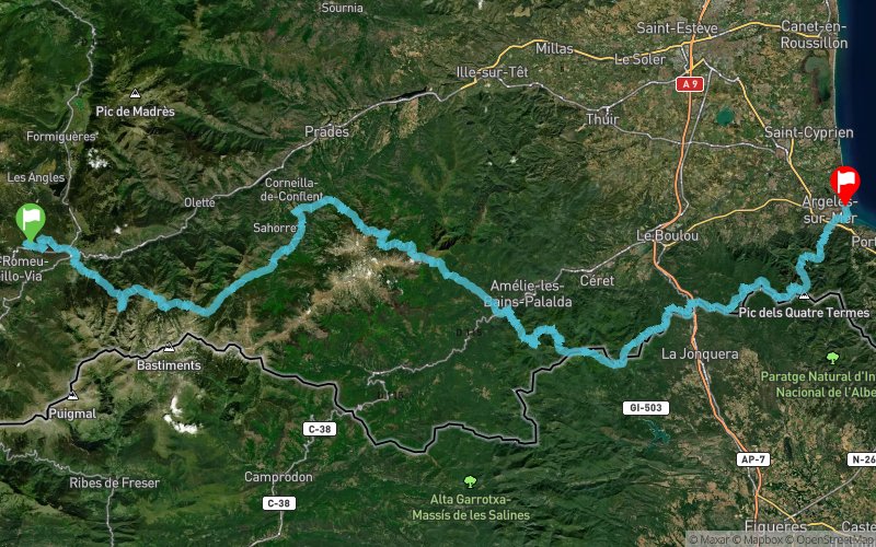


 Bolquère (66)
 Argelès-sur-Mer (66)
Race from mountains to the Sea
Points of Interest table
| Accum. | Intermediary | |||||||
|---|---|---|---|---|---|---|---|---|
| POI | Description | Alt. | Dist. | D+ | D- | Dist. | D+ | D- |
 Competition organized on 10/05/2018
Trace n°51652
Ascent threshold : 3 m Distance threshold : 30 m Smoothing : Yes Origin of altitudes : MNT Google
Ascent threshold : 3 m Distance threshold : 30 m Smoothing : Yes Origin of altitudes : MNT Google
Crossing
Dominant terrain : Footpath
Max alti. : 2379 m
Avg alti. : 1126 m
Min alti. : 0 m
Longest ascent : 1590 m
Longest descent : 1530 m
Dominant terrain : Footpath
Max alti. : 2379 m
Avg alti. : 1126 m
Min alti. : 0 m
Longest ascent : 1590 m
Longest descent : 1530 m
More tools
Create a new roadbook page
Map and track on your website
Warning ! When you insert a Trace de Trail map on your website, you agree not to hide any element of the module (links to Trail Trail or Trail Connect banner)
Add a realisation
Validate
Add a realisation to share your chrono and describe the conditions that you encountered during you trail running !
Show the infos
Add a track


