
Ferney Trail 2018
ITRA
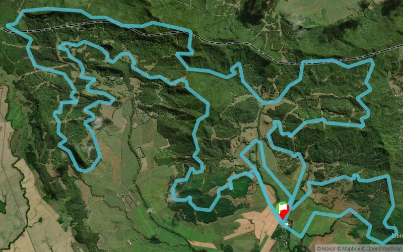
 50.1 km
2530 m
2530 m
50.1 km
2530 m
2530 m

GPX
9
PDF
Profile
Share
3D
Favorites
Reviews
Like
Inconnu (MU) (MU)
Effort kilometer
Longest ascent
Longest descent
75
280 m
400 m
Max. elevation
Min. elevation
Quality index
461 m
14 m
 1pt/3m
Starts at old sugar factory surrounded by sugar cane fields, and after traversing the canefields, it leaves the flat plantation and climbs the Lion Mountain on singletrack. After a descent, returning to the factory in a 7km loop, the trail follows a magnificent series of tracks and paths through primary forest and open rolling hills, climbing and descending several times, crossing streams and rivers to finally return to the start point.
En voir plus... En voir moins...

Start
Distance
0 km
Altitude
20 m
D+
0 m
D-
0 m
50.1 km
2530 m
2530 m
Finish
Distance
50.1 km
Altitude
20 m
D+
2530 m
D-
2530 m
Click on a point of interest to display it on the map
Reviews and times
Add a track
Ferney Trail 2018

Track number : 50269
Link to track :
https://tracedetrail.fr/en/trace/50269
Log in to insert this track on your website
 Trace de Trail