Show the map
Evaluated Track - ITRA
Desafio42K 2018 - Serra de Itabaiana - 42 km
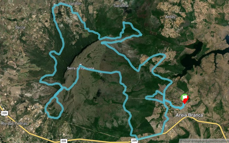


 Areia Branca (BR)


The Serra de Itabaiana National Park is a conservation unit located in the municipalities of Itabaiana and Areia Branca, state of Sergipe, Brazil, 40 km from the Aracaju Capital.
It has an area of ??7,998.99 hectares and is the second highest point of the relief of the state of Sergipe, with 659m of altitude.
There are waterfalls and crystalline water wells, such as the Poço das Maças, Via Sacra Trail, Piçarra, Cauldron, Cars and Paredão.
It is in this paradise that we will receive you for the 42k Serra de Itabaiana 2018 Challenge, a mountain race to be held in the Municipality of Areia Branca, Sergipe on July 8, 2018.
A high-level trail run competition where athletes will face a wild environment that will provide a unique and safe challenge.
Routes of 5, 10, 21 and 42km.
Lots of mud, streams, waterfalls, steep climbs and breathtaking visuals will be part of the routes.
Points of Interest table
| Accum. | Intermediary | |||||||
|---|---|---|---|---|---|---|---|---|
| POI | Description | Alt. | Dist. | D+ | D- | Dist. | D+ | D- |
 Competition organized on 07/08/2018
Trace n°48478
Ascent threshold : 3 m Distance threshold : 30 m Smoothing : Yes Origin of altitudes : MNT Google
Ascent threshold : 3 m Distance threshold : 30 m Smoothing : Yes Origin of altitudes : MNT Google
Loop
Dominant terrain : Footpath
Max alti. : 654 m
Avg alti. : 294 m
Min alti. : 84 m
Longest ascent : 480 m
Longest descent : 470 m
Dominant terrain : Footpath
Max alti. : 654 m
Avg alti. : 294 m
Min alti. : 84 m
Longest ascent : 480 m
Longest descent : 470 m
Elevation profile
More tools
Create a new roadbook page
Map and track on your website
Warning ! When you insert a Trace de Trail map on your website, you agree not to hide any element of the module (links to Trail Trail or Trail Connect banner)
Add a realisation
Validate
Add a realisation to share your chrono and describe the conditions that you encountered during you trail running !
Add a comment
Validate
Show the infos
Add a track


