Show the map
Certified Track - ITRA
La Cursa del Pastisset 2018


 Benifallet (ES)


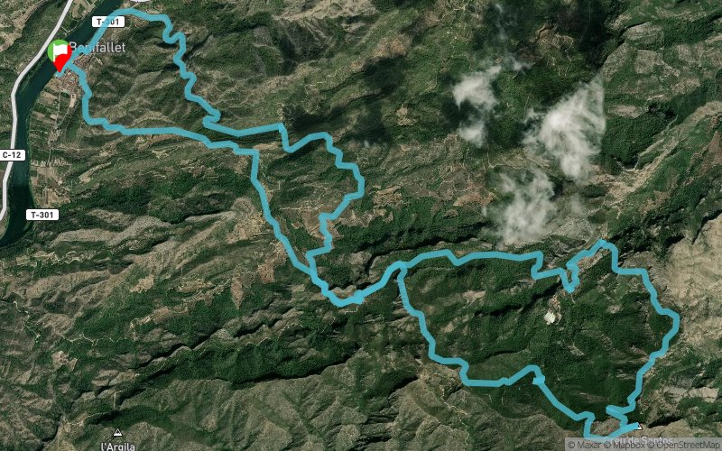
La Cursa del Pastisset in Benifallet (Catalonia) is one of the first in the calendar of the Terres de l'Ebre Mountain Race Circuit. Next January, la Cursa del Pastisset is going to celebrate its 9th edition. The tour of the race starts in Benifallet, a small town near Ebre river. After a very short urban track, the tour directs to Serra de Cardó mountains through a high technical circuit that ends at the highest point at 920 m of altitude , La Creu de Santos. The race is promoted by the association Fent Sendera, but people in the town give their best to ensure a safe, joyful and indispensable event for the runners.
Points of Interest table
| Accum. | Intermediary | |||||||
|---|---|---|---|---|---|---|---|---|
| POI | Description | Alt. | Dist. | D+ | D- | Dist. | D+ | D- |
 Competition organized on 01/28/2018
Trace n°48410
Ascent threshold : 3 m Distance threshold : 0 m Smoothing : No Origin of altitudes : GPS
Ascent threshold : 3 m Distance threshold : 0 m Smoothing : No Origin of altitudes : GPS
Loop
Dominant terrain : Footpath
Max alti. : 934 m
Avg alti. : 376 m
Min alti. : 3 m
Longest ascent : 720 m
Longest descent : 560 m
Dominant terrain : Footpath
Max alti. : 934 m
Avg alti. : 376 m
Min alti. : 3 m
Longest ascent : 720 m
Longest descent : 560 m
Elevation profile
More tools
Create a new roadbook page
Map and track on your website
Warning ! When you insert a Trace de Trail map on your website, you agree not to hide any element of the module (links to Trail Trail or Trail Connect banner)
Add a realisation
Validate
Add a realisation to share your chrono and describe the conditions that you encountered during you trail running !
Add a comment
Validate
Show the infos
Add a track


