Show the map
Montée du Ménez-Hom
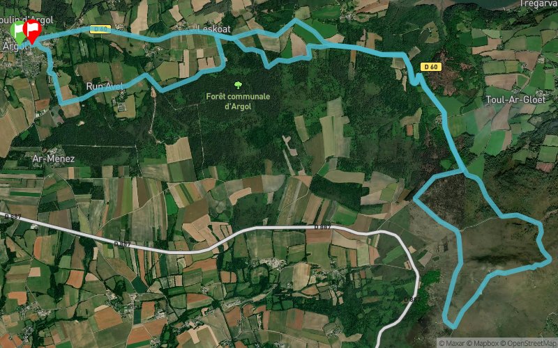


22.2 km
544 m
544 m
 Argol (29)
 Argol (29)
 Points of Interest table
| Accum. | Intermediary | |||||||
|---|---|---|---|---|---|---|---|---|
| POI | Description | Alt. | Dist. | D+ | D- | Dist. | D+ | D- |
 Competition organized on 08/17/2014
Trace n°4747
Ascent threshold : 0 m Distance threshold : 35 m Smoothing : Yes Origin of altitudes : MNT Aster GDEM
Ascent threshold : 0 m Distance threshold : 35 m Smoothing : Yes Origin of altitudes : MNT Aster GDEM
Loop
Dominant terrain : Path
Max alti. : 322 m
Avg alti. : 120 m
Min alti. : 47 m
Longest ascent : 285 m
Longest descent : 301 m
Dominant terrain : Path
Max alti. : 322 m
Avg alti. : 120 m
Min alti. : 47 m
Longest ascent : 285 m
Longest descent : 301 m
Elevation profile
More tools
Create a new roadbook page
Map and track on your website
Warning ! When you insert a Trace de Trail map on your website, you agree not to hide any element of the module (links to Trail Trail or Trail Connect banner)
Add a realisation
Validate
Add a realisation to share your chrono and describe the conditions that you encountered during you trail running !
Add a comment
Validate
mxcoco
30/10/16, 08:34:39
Sur les 22km, il ya 12 km( 6km aller et 6km retour) qui ne servent à rien, on est sur la route c'est plat bref inutile et dangereux. La partie dans le menez hom est chouette. J'ai fait 32km du coup et je me serais bien passé des km sur route...
30/10/16, 08:34:39
Sur les 22km, il ya 12 km( 6km aller et 6km retour) qui ne servent à rien, on est sur la route c'est plat bref inutile et dangereux. La partie dans le menez hom est chouette. J'ai fait 32km du coup et je me serais bien passé des km sur route...
Show the infos
Add a track


