Show the map
Fond Froide - Rilly - Bouthon - Chevenet
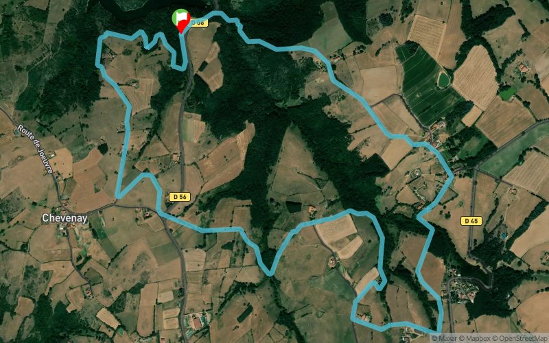


8.54 km
286 m
286 m
 Cordelle (42)
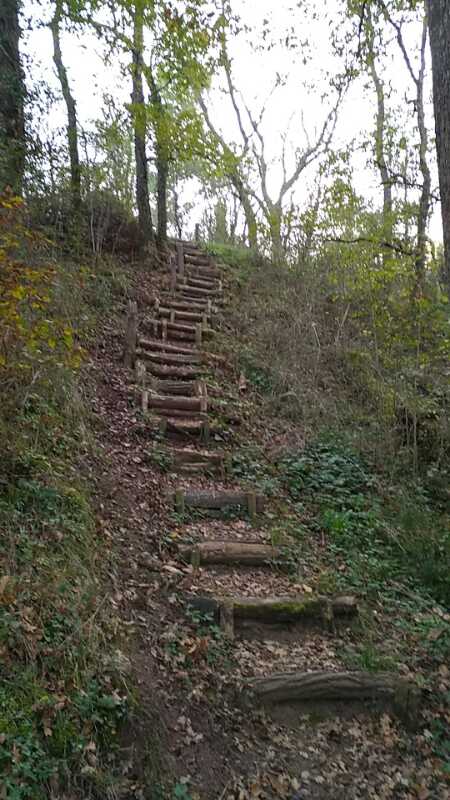

Points of Interest table
| Accum. | Intermediary | |||||||
|---|---|---|---|---|---|---|---|---|
| POI | Description | Alt. | Dist. | D+ | D- | Dist. | D+ | D- |
Trace n°46770
Ascent threshold : 0 m Distance threshold : 0 m Smoothing : No Origin of altitudes : TrailConnect Android (baro) - MNT IGN
Ascent threshold : 0 m Distance threshold : 0 m Smoothing : No Origin of altitudes : TrailConnect Android (baro) - MNT IGN
Loop
Dominant terrain : Path
Max alti. : 443 m
Avg alti. : 404 m
Min alti. : 323 m
Longest ascent : 130 m
Longest descent : 110 m
Route completed by the author : Yes
Dominant terrain : Path
Max alti. : 443 m
Avg alti. : 404 m
Min alti. : 323 m
Longest ascent : 130 m
Longest descent : 110 m
Route completed by the author : Yes
Elevation profile
More tools
Create a new roadbook page
Map and track on your website
Warning ! When you insert a Trace de Trail map on your website, you agree not to hide any element of the module (links to Trail Trail or Trail Connect banner)
Add a realisation
Validate
Add a comment
Validate
Show the infos
Add a track


