Show the map
Certified Track - ITRA
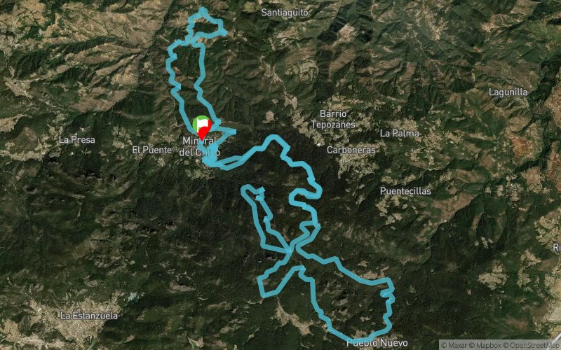
Ultra Trail Race El Chico Hidalgo 2017


 El Puente (MX)


Ascending route on terraces, paths and trails passing through Molcajetes and arriving at Peña del Cuervo (2770 masl) returning by the same road to reach Mineral del Chico
Points of Interest table
| Accum. | Intermediary | |||||||
|---|---|---|---|---|---|---|---|---|
| POI | Description | Alt. | Dist. | D+ | D- | Dist. | D+ | D- |
 Competition organized on 12/09/2017
Trace n°45906
Ascent threshold : 3 m Distance threshold : 0 m Smoothing : No Origin of altitudes : GPS
Ascent threshold : 3 m Distance threshold : 0 m Smoothing : No Origin of altitudes : GPS
Loop
Dominant terrain : Footpath
Max alti. : 2948 m
Avg alti. : 2601 m
Min alti. : 2039 m
Longest ascent : 580 m
Longest descent : 620 m
Dominant terrain : Footpath
Max alti. : 2948 m
Avg alti. : 2601 m
Min alti. : 2039 m
Longest ascent : 580 m
Longest descent : 620 m
Elevation profile
More tools
Create a new roadbook page
Map and track on your website
Warning ! When you insert a Trace de Trail map on your website, you agree not to hide any element of the module (links to Trail Trail or Trail Connect banner)
Add a realisation
Validate
Add a realisation to share your chrono and describe the conditions that you encountered during you trail running !
Add a comment
Validate
Show the infos
Add a track


