Show the map
Certified Track - ITRA
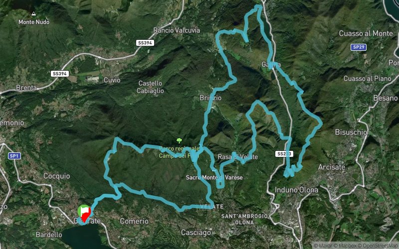
Eolo Campo Dei Fiori Trail 2017 - Ultra CFT 65K


 Gavirate (IT)


The competition will be valid for ITALIAN CHAMPION TRAIL RUNNING LONG distance.
Starting from Varese lake (Gavirate lido) and developing between forests of beech, chestnut, linden and maple trees. Going up to the mountain scenic areas abound: Mount St. Francis, the steps of the funicular, chapels of the Sacred Mount, Rasa, Pian Valdes, Mount Chiuserella and Martica, the St. Bernard, Mount Poncione, Ghirla lake, Mount Mondonico, Pass Pizzelle, Mount three Crosses, of Middle Point.
In summary a full route where the competitor will get in the competition distracted by the spectacle of breathtaking views.
Points of Interest table
| Accum. | Intermediary | |||||||
|---|---|---|---|---|---|---|---|---|
| POI | Description | Alt. | Dist. | D+ | D- | Dist. | D+ | D- |
 Competition organized on 09/23/2017
Trace n°45535
Ascent threshold : 10 m Distance threshold : 0 m Smoothing : No Origin of altitudes : GPS
Ascent threshold : 10 m Distance threshold : 0 m Smoothing : No Origin of altitudes : GPS
Loop
Dominant terrain : Footpath
Max alti. : 1208 m
Avg alti. : 726 m
Min alti. : 241 m
Longest ascent : 610 m
Longest descent : 880 m
Dominant terrain : Footpath
Max alti. : 1208 m
Avg alti. : 726 m
Min alti. : 241 m
Longest ascent : 610 m
Longest descent : 880 m
Elevation profile
More tools
Create a new roadbook page
Map and track on your website
Warning ! When you insert a Trace de Trail map on your website, you agree not to hide any element of the module (links to Trail Trail or Trail Connect banner)
Add a realisation
Validate
Add a realisation to share your chrono and describe the conditions that you encountered during you trail running !
Add a comment
Validate
Show the infos
Add a track


