Show the map
Certified Track - ITRA
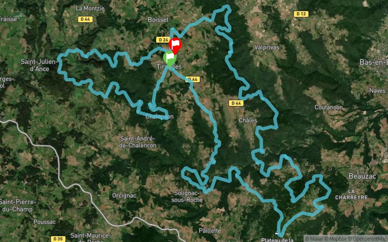
Techni'trail de Tiranges 2018 - UTTT


 Tiranges (43)
 Tiranges (43)


The extreme race of the Techni Trail de Tiranges takes a very demanding course because of the chain of many difficulties that takes the runners in unusual places. The start of the race is not very technical with rather rolling trails until the first refueling located at kilometer 20. The suite offers many very technical parts as well as an interesting vertical drop of + 5000 meters. A few more rolling paths will allow the runners to relaunch through the Bezan jump before arriving at the famous climb in the heart of the lava flow of Bourrianne and then the medieval castle of Chalencon. This course is aimed at experienced riders. Five refreshments will be proposed. The companions will find their GPS coordinates on the site of the TTT as well as those places where it is possible to see the courageous competitors pass.
Points of Interest table
| Accum. | Intermediary | |||||||
|---|---|---|---|---|---|---|---|---|
| POI | Description | Alt. | Dist. | D+ | D- | Dist. | D+ | D- |
 Competition organized on 05/06/2018
Trace n°43046
Ascent threshold : 10 m Distance threshold : 0 m Smoothing : No Origin of altitudes : GPS
Ascent threshold : 10 m Distance threshold : 0 m Smoothing : No Origin of altitudes : GPS
Loop
Dominant terrain : Footpath
Max alti. : 1015 m
Avg alti. : 718 m
Min alti. : 439 m
Longest ascent : 470 m
Longest descent : 430 m
Dominant terrain : Footpath
Max alti. : 1015 m
Avg alti. : 718 m
Min alti. : 439 m
Longest ascent : 470 m
Longest descent : 430 m
Elevation profile
More tools
Create a new roadbook page
Map and track on your website
Warning ! When you insert a Trace de Trail map on your website, you agree not to hide any element of the module (links to Trail Trail or Trail Connect banner)
Add a realisation
Validate
Add a realisation to share your chrono and describe the conditions that you encountered during you trail running !
Add a comment
Validate
Show the infos
Add a track


