Show the map
Ultra-Trail® du Bout du Monde 2017 - 140K
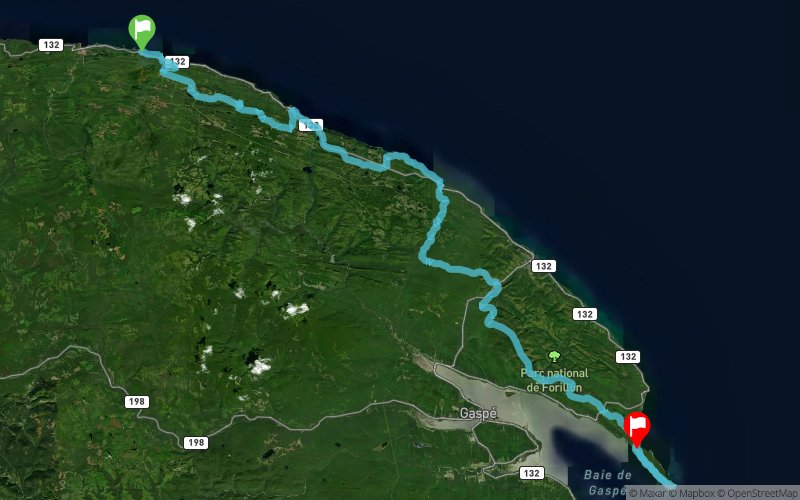


 Inconnu (CA)
 Gaspé (CA)
TUNNING MOUNTAINS
Ultra-Trail® du Bout du Monde, created in partnership with Parks Canada, is a unique experience that will allow runners of all levels to discover seascapes and breathtaking mountains and unique in Canada.
CREATE BY RUNNERS
Ultra-Trail® du Bout du Monde (UTBdM) was created by the runers on trail. It has been developed by Land’s End Expedition Racing, popular Canadian Festival organizer Skyrunning and the Ultra-Trail® du Mont Albert (UTMA) in Gaspésie National Park. The UTBdM promises to be another great success for the community of trail running, Gaspésie and Quebec.
AUTUMN COLORS
The races take place in the Forillon Peninsula amid the fall colors, and will include courses from 10 to 135 km. Family races of 800 meters and 3 km are also planned for the next generation of runners.
FORILLON PARK
Ultra-Trail® du Bout du Monde was created to showcase the natural beauty and incomparable Forillon National Park and ensure its national and international visibility. The UTBdM continue to cement the Gaspé reputation as new paths of racing Mecca in the eastern provinces of Canada.
Points of Interest table
| Accum. | Intermediary | |||||||
|---|---|---|---|---|---|---|---|---|
| POI | Description | Alt. | Dist. | D+ | D- | Dist. | D+ | D- |
 Competition organized on 09/23/2017
Trace n°39370
Ascent threshold : 3 m Distance threshold : 30 m Smoothing : Yes Origin of altitudes : MNT Google
Ascent threshold : 3 m Distance threshold : 30 m Smoothing : Yes Origin of altitudes : MNT Google
Crossing
Dominant terrain : Footpath
Max alti. : 492 m
Avg alti. : 185 m
Min alti. : 0 m
Longest ascent : 360 m
Longest descent : 330 m
Dominant terrain : Footpath
Max alti. : 492 m
Avg alti. : 185 m
Min alti. : 0 m
Longest ascent : 360 m
Longest descent : 330 m
Elevation profile
More tools
Create a new roadbook page
Map and track on your website
Warning ! When you insert a Trace de Trail map on your website, you agree not to hide any element of the module (links to Trail Trail or Trail Connect banner)
Add a realisation
Validate
Add a realisation to share your chrono and describe the conditions that you encountered during you trail running !
Add a comment
Validate
Show the infos
Add a track


