Show the map
Evaluated Track - ITRA
Trail des Passerelles du Monteynard 2017 - La Grande Course 65 km
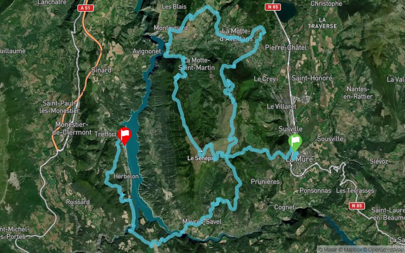


 La Mure (38)
 Treffort (38)


65km and 3500m D+ Trail, starting with 50km in the Matheysine area, discovering touristical, natural, cultural and historical wonders. Then you cross our 2 himalayan bridges to finish along the lake in the Trièves area
Points of Interest table
| Accum. | Intermediary | |||||||
|---|---|---|---|---|---|---|---|---|
| POI | Description | Alt. | Dist. | D+ | D- | Dist. | D+ | D- |
 Competition organized on 07/16/2017
Trace n°39320
Ascent threshold : 3 m Distance threshold : 30 m Smoothing : Yes Origin of altitudes : MNT Google
Ascent threshold : 3 m Distance threshold : 30 m Smoothing : Yes Origin of altitudes : MNT Google
Crossing
Dominant terrain : Footpath
Max alti. : 1759 m
Avg alti. : 1024 m
Min alti. : 491 m
Longest ascent : 1210 m
Longest descent : 1390 m
Dominant terrain : Footpath
Max alti. : 1759 m
Avg alti. : 1024 m
Min alti. : 491 m
Longest ascent : 1210 m
Longest descent : 1390 m
Elevation profile
More tools
Create a new roadbook page
Map and track on your website
Warning ! When you insert a Trace de Trail map on your website, you agree not to hide any element of the module (links to Trail Trail or Trail Connect banner)
Add a realisation
Validate
Add a realisation to share your chrono and describe the conditions that you encountered during you trail running !
Add a comment
Validate
Show the infos
Add a track


