Show the map
Certified Track - ITRA
Sundsvall Trail 2017 - 28 km
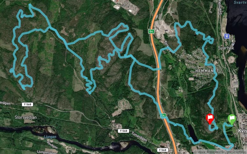


 Kvissleby (SE)
 Kvissleby (SE)


2017 will be the debut year of this trail race, taking place in the beautiful coast municipality of Sundsvall, the course takes you from the Bothnian Ocean and back again, through deep pathless wildwoods and over beautiful hills, on winding singel track trails and off trail. And as a bonus, you will become acquainted with our knee high heather and wet marshes!
Points of Interest table
| Accum. | Intermediary | |||||||
|---|---|---|---|---|---|---|---|---|
| POI | Description | Alt. | Dist. | D+ | D- | Dist. | D+ | D- |
 Competition organized on 06/04/2017
Trace n°39246
Ascent threshold : 10 m Distance threshold : 0 m Smoothing : No Origin of altitudes : GPS
Ascent threshold : 10 m Distance threshold : 0 m Smoothing : No Origin of altitudes : GPS
Loop
Dominant terrain : Footpath
Max alti. : 263 m
Avg alti. : 157 m
Min alti. : 22 m
Longest ascent : 160 m
Longest descent : 160 m
Dominant terrain : Footpath
Max alti. : 263 m
Avg alti. : 157 m
Min alti. : 22 m
Longest ascent : 160 m
Longest descent : 160 m
Elevation profile
More tools
Create a new roadbook page
Map and track on your website
Warning ! When you insert a Trace de Trail map on your website, you agree not to hide any element of the module (links to Trail Trail or Trail Connect banner)
Add a realisation
Validate
Add a realisation to share your chrono and describe the conditions that you encountered during you trail running !
Add a comment
Validate
Show the infos
Add a track


