Show the map
Certified Track - ITRA
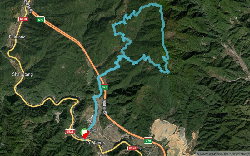
Fujian Jiangle 50 International Trail Challenge 2017 - Half Course Group


 Inconnu (CN)


“2017??50”??7?15?16???????????????????????????260??????“???????????”??“??”?????????????????????26?????????
???????????????????????????????????????????????????????????????????????????????????????????????1.5?????????????????2?????????????????????????60???
????????????????????????????????????????1640.2??
?????????????85.2%??????????????????????????????19.8?????????“???????”?
Points of Interest table
| Accum. | Intermediary | |||||||
|---|---|---|---|---|---|---|---|---|
| POI | Description | Alt. | Dist. | D+ | D- | Dist. | D+ | D- |
 Competition organized on 07/16/2017
Trace n°39185
Ascent threshold : 3 m Distance threshold : 0 m Smoothing : No Origin of altitudes : GPS
Ascent threshold : 3 m Distance threshold : 0 m Smoothing : No Origin of altitudes : GPS
Loop
Dominant terrain : Footpath
Max alti. : 1058 m
Avg alti. : 577 m
Min alti. : 159 m
Longest ascent : 940 m
Longest descent : 890 m
Dominant terrain : Footpath
Max alti. : 1058 m
Avg alti. : 577 m
Min alti. : 159 m
Longest ascent : 940 m
Longest descent : 890 m
Elevation profile
More tools
Create a new roadbook page
Map and track on your website
Warning ! When you insert a Trace de Trail map on your website, you agree not to hide any element of the module (links to Trail Trail or Trail Connect banner)
Add a realisation
Validate
Add a realisation to share your chrono and describe the conditions that you encountered during you trail running !
Add a comment
Validate
Show the infos
Add a track


