Show the map
Belasitsa Sky Run 2017


 Mokrievo (BG)
 ?????? / Petrich (BG)
Belasitsa Sky Run is a trail race that follows the ridge of one of the mountains with the most beautiful panoramas on the Balkan Peninsula.
During the event the participants will enjoy views of three countries (Bulgaria, FYR Macedonia and Greece) and will see the three highest mountains on the Balkans (Rila, Olympus and Pirin). Two beautiful lakes (Dojran and Kerkini) make the panoramas even more breathtaking, while Struma River valley and the picturesque villages at the foot of the Mountain add to the atmosphere of the race. The trail passes next to beautiful waterfalls, among them the highest waterfall in FYR Macedonia - Smolarski and the Shy (Kamenishki) waterfall in Bulgaria which is shyly hidden deep in the slopes of the Mountain. The participants will also have the opportunity to run in midst of the centuries-old chestnut forests - the symbol of Belasitsa Mountain.
Belasitsa Sky Run is the first international trail running race between Bulgaria and FYR Macedonia and aims to bring together the outdoor lovers from both countries and provide them with a place for a friendly competition and a forum for exchange of ideas and entertainment.
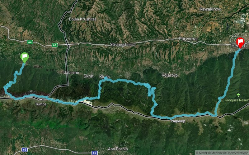
The route of Belasitsa Sky Run is 63.7 km long and starts from the village of Smolari in Macedonia, climbs steeply to the Mountain ridge, passes through the challenging Cut Rock Peak (1785 m.a.s.l.) and crosses the border with Bulgaria under the Tumba Peak, where the borders of Bulgaria, FYR Macedonia and Greece meet. On the Bulgarian territory the route continues with a picturesque passage on top of the Mountain ridge and descending to the village of Klyuch from where a new challenging ascent begins to the highest peak of Belasitsa - Radomir (2029 m.a.s.l.) continues along the ridge to the east to Kongur Peak and descends through centuries-old beech and chestnut forests to the final in Petrich.
Points of Interest table
| Accum. | Intermediary | |||||||
|---|---|---|---|---|---|---|---|---|
| POI | Description | Alt. | Dist. | D+ | D- | Dist. | D+ | D- |
 Competition organized on 10/07/2017
Trace n°39180
Ascent threshold : 3 m Distance threshold : 0 m Smoothing : No Origin of altitudes : GPS
Ascent threshold : 3 m Distance threshold : 0 m Smoothing : No Origin of altitudes : GPS
Crossing
Dominant terrain : Path
Max alti. : 2028 m
Avg alti. : 1287 m
Min alti. : 217 m
Longest ascent : 1610 m
Longest descent : 1750 m
Dominant terrain : Path
Max alti. : 2028 m
Avg alti. : 1287 m
Min alti. : 217 m
Longest ascent : 1610 m
Longest descent : 1750 m
Elevation profile
More tools
Create a new roadbook page
Map and track on your website
Warning ! When you insert a Trace de Trail map on your website, you agree not to hide any element of the module (links to Trail Trail or Trail Connect banner)
Add a realisation
Validate
Add a realisation to share your chrono and describe the conditions that you encountered during you trail running !
Add a comment
Validate
Show the infos
Add a track


