Show the map
Étang de Peyregrand - Étang de Gnioure
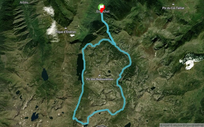


25.5 km
1970 m
1970 m
 Siguer (09)
 Points of Interest table
| Accum. | Intermediary | |||||||
|---|---|---|---|---|---|---|---|---|
| POI | Description | Alt. | Dist. | D+ | D- | Dist. | D+ | D- |
Trace n°38384
Ascent threshold : 3 m Distance threshold : 30 m Smoothing : Yes Origin of altitudes : MNT Aster GDEM
Ascent threshold : 3 m Distance threshold : 30 m Smoothing : Yes Origin of altitudes : MNT Aster GDEM
Loop
Dominant terrain : Footpath
Max alti. : 2695 m
Avg alti. : 1786 m
Min alti. : 958 m
Longest ascent : 1760 m
Longest descent : 1060 m
Route completed by the author : nc
Dominant terrain : Footpath
Max alti. : 2695 m
Avg alti. : 1786 m
Min alti. : 958 m
Longest ascent : 1760 m
Longest descent : 1060 m
Route completed by the author : nc
Elevation profile
More tools
Create a new roadbook page
Map and track on your website
Warning ! When you insert a Trace de Trail map on your website, you agree not to hide any element of the module (links to Trail Trail or Trail Connect banner)
Add a realisation
Validate
Add a realisation to share your chrono and describe the conditions that you encountered during you trail running !
Add a comment
Validate
john12
23/07/17, 20:57:41
Pas de sentier balisé entre le 10ème km et 14ème km et avec du fort dénivelé négatif. Très dangereux, à ne surtout pas tenter !!!
23/07/17, 20:57:41
Pas de sentier balisé entre le 10ème km et 14ème km et avec du fort dénivelé négatif. Très dangereux, à ne surtout pas tenter !!!
Show the infos
Add a track


