Show the map
Evaluated Track - ITRA
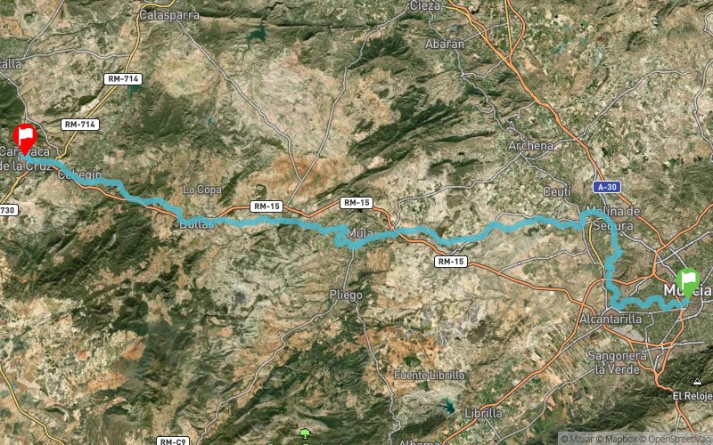
90K Camino de la Cruz 2017


 Murcia (ES)
 Cehegin (ES)


The 90K Camino de la Cruz is a pedestrian sports event celebrated on the occasion of the Jubilee Year 2017. The route combines the homologated trails of the GR 127 "Segura River Trail", along the Segura River between Murcia and Molina de Segura, And the GR 250 "Road of the Apostle", by the Green Road between Molina de Segura and Caravaca de la Cruz with a distance of approximately 90 kilometers to the finish line, which is in the Royal Basilica of Vera Cruz in Caravaca. It is a competitive and eliminatory race that establishes control points in the course that have a maximum of 24 hours to reach the goal in Caravaca de la Cruz.
Points of Interest table
| Accum. | Intermediary | |||||||
|---|---|---|---|---|---|---|---|---|
| POI | Description | Alt. | Dist. | D+ | D- | Dist. | D+ | D- |
 Competition organized on 10/07/2017
Trace n°35750
Ascent threshold : 3 m Distance threshold : 0 m Smoothing : No Origin of altitudes : GPS
Ascent threshold : 3 m Distance threshold : 0 m Smoothing : No Origin of altitudes : GPS
Crossing
Dominant terrain : Path
Max alti. : 664 m
Avg alti. : 302 m
Min alti. : 50 m
Longest ascent : 1050 m
Longest descent : 50 m
Dominant terrain : Path
Max alti. : 664 m
Avg alti. : 302 m
Min alti. : 50 m
Longest ascent : 1050 m
Longest descent : 50 m
Elevation profile
More tools
Create a new roadbook page
Map and track on your website
Warning ! When you insert a Trace de Trail map on your website, you agree not to hide any element of the module (links to Trail Trail or Trail Connect banner)
Add a realisation
Validate
Add a realisation to share your chrono and describe the conditions that you encountered during you trail running !
Add a comment
Validate
Show the infos
Add a track


