Show the map
Evaluated Track - ITRA
Likya Trail Series 2017
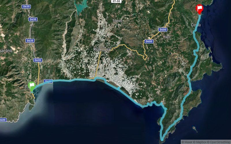


 Finike (TR)
 Ulupinar (TR)

A brand new series on the historical Lycian Way!
3 different tracks on 3 different dates…
A unique track that passes from Gelidonya Lighthouse and Mount Musa to end at Ç?ral?…
Weather increases the distance gradually or run the longest each time…
Lycia Trail Series is your chance to run one of the most special and technical tracks in Turkey!
Points of Interest table
| Accum. | Intermediary | |||||||
|---|---|---|---|---|---|---|---|---|
| POI | Description | Alt. | Dist. | D+ | D- | Dist. | D+ | D- |
 Competition organized on 05/13/2017
Trace n°35382
Ascent threshold : 3 m Distance threshold : 30 m Smoothing : Yes Origin of altitudes : MNT Google
Ascent threshold : 3 m Distance threshold : 30 m Smoothing : Yes Origin of altitudes : MNT Google
Crossing
Dominant terrain : Footpath
Max alti. : 724 m
Avg alti. : 113 m
Min alti. : 0 m
Longest ascent : 740 m
Longest descent : 730 m
Dominant terrain : Footpath
Max alti. : 724 m
Avg alti. : 113 m
Min alti. : 0 m
Longest ascent : 740 m
Longest descent : 730 m
Elevation profile
More tools
Create a new roadbook page
Map and track on your website
Warning ! When you insert a Trace de Trail map on your website, you agree not to hide any element of the module (links to Trail Trail or Trail Connect banner)
Add a realisation
Validate
Add a realisation to share your chrono and describe the conditions that you encountered during you trail running !
Add a comment
Validate
Show the infos
Add a track


