Show the map
OFFICIAL ROUTE
Mozart 100® 2017 - Scenic Light
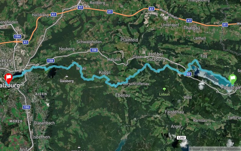


30.5 km
1160 m
1390 m
 Fuschl am See (AT)
 Salzburg (AT)
 4
4 230
230 Points of Interest table
| Accum. | Intermediary | |||||||
|---|---|---|---|---|---|---|---|---|
| POI | Description | Alt. | Dist. | D+ | D- | Dist. | D+ | D- |
 Competition organized on 06/17/2017
Trace n°35306
Ascent threshold : 10 m Distance threshold : 0 m Smoothing : No Origin of altitudes : GPS
Ascent threshold : 10 m Distance threshold : 0 m Smoothing : No Origin of altitudes : GPS
Crossing
Dominant terrain : Path
Max alti. : 993 m
Avg alti. : 728 m
Min alti. : 418 m
Longest ascent : 230 m
Longest descent : 500 m
Dominant terrain : Path
Max alti. : 993 m
Avg alti. : 728 m
Min alti. : 418 m
Longest ascent : 230 m
Longest descent : 500 m
Elevation profile
More tools
Create a new roadbook page
Map and track on your website
Warning ! When you insert a Trace de Trail map on your website, you agree not to hide any element of the module (links to Trail Trail or Trail Connect banner)
Add a realisation
Validate
Add a realisation to share your chrono and describe the conditions that you encountered during you trail running !
Add a comment
Validate
Show the infos
Add a track


