Show the map
OFFICIAL ROUTE
Le Trail des 4 Communes 2017
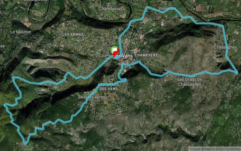


20.8 km
1650 m
1640 m
 Les Vans (07)
 Points of Interest table
| Accum. | Intermediary | |||||||
|---|---|---|---|---|---|---|---|---|
| POI | Description | Alt. | Dist. | D+ | D- | Dist. | D+ | D- |
 Competition organized on 10/22/2017
Trace n°35069
Ascent threshold : 3 m Distance threshold : 0 m Smoothing : No Origin of altitudes : GPS
Ascent threshold : 3 m Distance threshold : 0 m Smoothing : No Origin of altitudes : GPS
Loop
Dominant terrain : Path
Max alti. : 587 m
Avg alti. : 300 m
Min alti. : 0 m
Longest ascent : 800 m
Longest descent : 980 m
Dominant terrain : Path
Max alti. : 587 m
Avg alti. : 300 m
Min alti. : 0 m
Longest ascent : 800 m
Longest descent : 980 m
Elevation profile
More tools
Create a new roadbook page
Map and track on your website
Warning ! When you insert a Trace de Trail map on your website, you agree not to hide any element of the module (links to Trail Trail or Trail Connect banner)
Add a realisation
Validate
Add a realisation to share your chrono and describe the conditions that you encountered during you trail running !
Add a comment
Validate
Admin - Trace de Trail
14/05/17, 19:15:39
Bonjour, Sur cette trace, les altitudes utilisées sont celles du fichier gpx de l'auteur et on voit sur le profil qu'il y a un décroché au km 14 et des microvariations un peu partout... En utilisant la méthode de calcul par défaut de Trace de Trail (MNT IGN en France), on obtient 20 km et 600m D+.
More comments
Show the infos
Add a track


