Show the map
OFFICIAL ROUTE
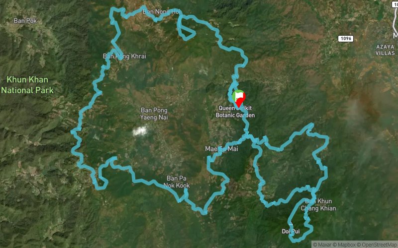
Pong Yaeng Trail 100 2017


 Weang Hang (TH)


Route reversal means that the 100K participants must face the Doi Pui summit first thing in the morning before heading back to Pong Yaeng valley. Then the route follows the PYT66 - which is just as testing. Tough time ahead!
Points of Interest table
| Accum. | Intermediary | |||||||
|---|---|---|---|---|---|---|---|---|
| POI | Description | Alt. | Dist. | D+ | D- | Dist. | D+ | D- |
 Competition organized on 11/04/2017
Trace n°34475
Ascent threshold : 3 m Distance threshold : 0 m Smoothing : No Origin of altitudes : GPS
Ascent threshold : 3 m Distance threshold : 0 m Smoothing : No Origin of altitudes : GPS
Loop
Dominant terrain : Path
Max alti. : 1669 m
Avg alti. : 1125 m
Min alti. : 599 m
Longest ascent : 1120 m
Longest descent : 670 m
Dominant terrain : Path
Max alti. : 1669 m
Avg alti. : 1125 m
Min alti. : 599 m
Longest ascent : 1120 m
Longest descent : 670 m
Elevation profile
More tools
Create a new roadbook page
Map and track on your website
Warning ! When you insert a Trace de Trail map on your website, you agree not to hide any element of the module (links to Trail Trail or Trail Connect banner)
Add a realisation
Validate
Add a realisation to share your chrono and describe the conditions that you encountered during you trail running !
Add a comment
Validate
Show the infos
Add a track


