Show the map
OFFICIAL ROUTE
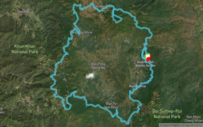
Pong Yaeng Trail 66 2017


 Weang Hang (TH)


A route reversal means 2017 PYT66 will take participants in an anti-clockwise fashion around the valley. Total elevation gain is the same as 2016 edition but with a very different profile.
Points of Interest table
| Accum. | Intermediary | |||||||
|---|---|---|---|---|---|---|---|---|
| POI | Description | Alt. | Dist. | D+ | D- | Dist. | D+ | D- |
 Competition organized on 11/04/2017
Trace n°34461
Ascent threshold : 3 m Distance threshold : 0 m Smoothing : No Origin of altitudes : GPS
Ascent threshold : 3 m Distance threshold : 0 m Smoothing : No Origin of altitudes : GPS
Loop
Dominant terrain : Path
Max alti. : 1439 m
Avg alti. : 1116 m
Min alti. : 632 m
Longest ascent : 500 m
Longest descent : 670 m
Dominant terrain : Path
Max alti. : 1439 m
Avg alti. : 1116 m
Min alti. : 632 m
Longest ascent : 500 m
Longest descent : 670 m
Elevation profile
More tools
Create a new roadbook page
Map and track on your website
Warning ! When you insert a Trace de Trail map on your website, you agree not to hide any element of the module (links to Trail Trail or Trail Connect banner)
Add a realisation
Validate
Add a realisation to share your chrono and describe the conditions that you encountered during you trail running !
Add a comment
Validate
Show the infos
Add a track


