
Pels Camins Dels Matxos 2017
ITRA
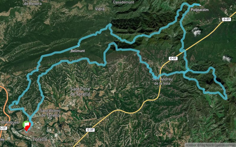
 61.3 km
3080 m
3090 m
61.3 km
3080 m
3090 m

GPX
417
PDF
Profile
Share
3D
Favorites
Reviews
Like
Torello (ES) ()
Effort kilometer
Longest ascent
Longest descent
92
790 m
670 m
Max. elevation
Min. elevation
Quality index
1527 m
529 m
 1pt/9m
Start
Distance
0 km
Altitude
538 m
D+
0 m
D-
0 m
61.3 km
3080 m
3090 m
Finish
Distance
61.3 km
Altitude
538 m
D+
3080 m
D-
3090 m
Click on a point of interest to display it on the map
Reviews and times
Add a track
Pels Camins Dels Matxos 2017

Track number : 32186
Link to track :
https://tracedetrail.fr/en/trace/32186
Log in to insert this track on your website
 Trace de Trail