Show the map
Certified Track - ITRA
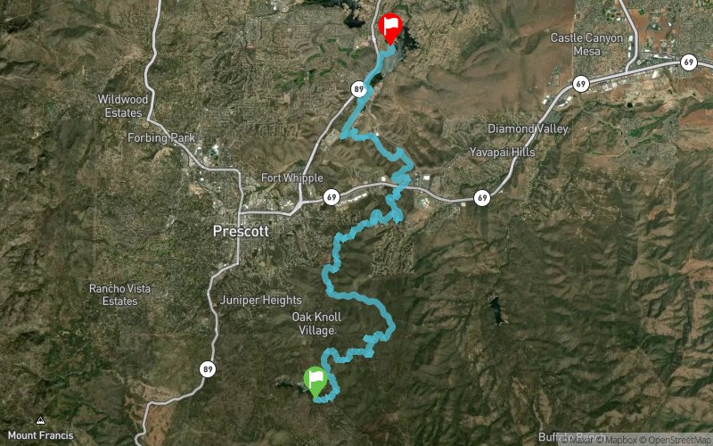
Whiskey Basin 2017 - 31 km


 Prescott (US)
 Prescott (US)


Welcome to the 2nd annual Whiskey Basin Trail Runs! These point to point endurance foot races will take place along the Prescott Circle Trail in beautiful Prescott, Arizona. Featuring a perfect mix of high desert trails, pines and junipers this route takes you completely around the City of Prescott on some of their best trails all while never being more than a few miles from the heart of downtown and Whiskey Row. Reserve a campsite right at the 88K start/finish line for Friday and Saturday nights of the event in scenic Watson Lake Park and join us for a post race bar crawl on the infamous Whiskey Row! The 10K course will also start and finish at Watson Lake Park with an out and back section on the Peavine and Watson Lake Trails taking in some of the beautiful Granite Dells.
Points of Interest table
| Accum. | Intermediary | |||||||
|---|---|---|---|---|---|---|---|---|
| POI | Description | Alt. | Dist. | D+ | D- | Dist. | D+ | D- |
 Competition organized on 04/08/2017
Trace n°28863
Ascent threshold : 3 m Distance threshold : 0 m Smoothing : No Origin of altitudes : GPS
Ascent threshold : 3 m Distance threshold : 0 m Smoothing : No Origin of altitudes : GPS
Crossing
Dominant terrain : Footpath
Max alti. : 2002 m
Avg alti. : 1773 m
Min alti. : 1572 m
Longest ascent : 160 m
Longest descent : 350 m
Dominant terrain : Footpath
Max alti. : 2002 m
Avg alti. : 1773 m
Min alti. : 1572 m
Longest ascent : 160 m
Longest descent : 350 m
Elevation profile
More tools
Create a new roadbook page
Map and track on your website
Warning ! When you insert a Trace de Trail map on your website, you agree not to hide any element of the module (links to Trail Trail or Trail Connect banner)
Add a realisation
Validate
Add a realisation to share your chrono and describe the conditions that you encountered during you trail running !
Add a comment
Validate
Show the infos
Add a track


