
Sandsjöbacka Trail 2017 - 22K
ITRA
 22 km
380 m
370 m
22 km
380 m
370 m

GPX
21
PDF
Profile
Share
3D
Favorites
Reviews
Like
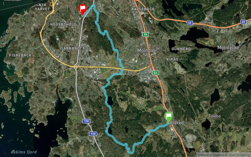
Kållered (SE) Hisings Backa (SE)
Effort kilometer
Longest ascent
Longest descent
25
110 m
100 m
Max. elevation
Min. elevation
Quality index
108 m
3 m
 1pt/10m
Start
Distance
0 km
Altitude
13 m
D+
0 m
D-
0 m
22 km
379 m
369 m
Finish
Distance
22 km
Altitude
22 m
D+
379 m
D-
369 m
Click on a point of interest to display it on the map
Reviews and times
Add a track
Sandsjöbacka Trail 2017 - 22K

Track number : 27574
Link to track :
https://tracedetrail.fr/en/trace/27574
Log in to insert this track on your website
 Trace de Trail