Show the map
Baou de St-Jeannet - Bézaudun-les-Alpes - Cheiron
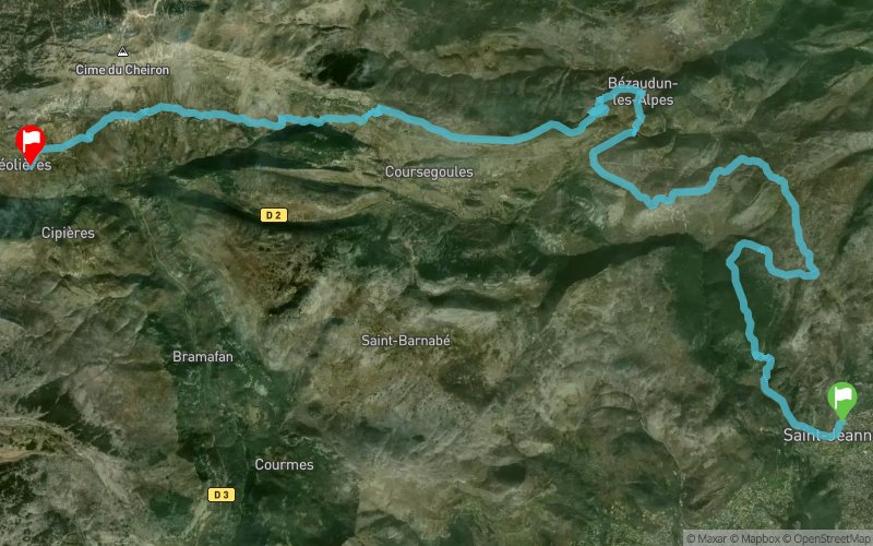


33.4 km
1650 m
1260 m
 Saint-Jeannet (06)
 Gréolières (06)
 Points of Interest table
| Accum. | Intermediary | |||||||
|---|---|---|---|---|---|---|---|---|
| POI | Description | Alt. | Dist. | D+ | D- | Dist. | D+ | D- |
Trace n°24404
Ascent threshold : 10 m Distance threshold : 30 m Smoothing : Yes Origin of altitudes : MNT Aster GDEM
Ascent threshold : 10 m Distance threshold : 30 m Smoothing : Yes Origin of altitudes : MNT Aster GDEM
Crossing
Dominant terrain : Footpath
Max alti. : 1412 m
Avg alti. : 960 m
Min alti. : 367 m
Longest ascent : 600 m
Longest descent : 360 m
Route completed by the author : nc
Dominant terrain : Footpath
Max alti. : 1412 m
Avg alti. : 960 m
Min alti. : 367 m
Longest ascent : 600 m
Longest descent : 360 m
Route completed by the author : nc
Elevation profile
More tools
Create a new roadbook page
Map and track on your website
Warning ! When you insert a Trace de Trail map on your website, you agree not to hide any element of the module (links to Trail Trail or Trail Connect banner)
Add a realisation
Validate
Add a realisation to share your chrono and describe the conditions that you encountered during you trail running !
Add a comment
Validate
UltraSteph06
25/07/16, 10:48:38
Superbe paysage entre mer et montagne. Parcours exigent avec de bonnes montées. Attention après Bézaudun, la trace n'est pas très lisible. Mais le spectacle est magique au dessus de Coursegoules
25/07/16, 10:48:38
Superbe paysage entre mer et montagne. Parcours exigent avec de bonnes montées. Attention après Bézaudun, la trace n'est pas très lisible. Mais le spectacle est magique au dessus de Coursegoules
Show the infos
Add a track


