Show the map
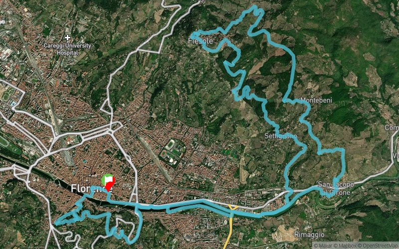
Firenze Urban Trail - 45 km


 Varlungo (IT)
An ultra-marathon run to get to know Florence (Italy) and its most famous hills: Settignano, Fiesole, Monte Ceceri. Firenze Urban Trail 45 km is half way between Urban and Cross-country Trail. The starting point is in Piazza Santa Croce at 8.30 am on Sunday, with a beautiful route unwinding in Piazza Signoria, the Uffizi Gallery Lodge, the Ponte Vecchio and Piazza Pitti going up as far as Monte alle Croci and San Miniato. Then down to the Arno, crossing Albereta Park and then along the bank of the Arno until Girone, then up the steep climb to Settignano. A single track in the wood up to the splendid Castel di Poggio and then the heart of Fiesole with its views and hidden lanes. A real trail up to the top of Monte Ceceri, where Leonardo da Vinci tested his flying machines, then downhill to the quarries of Maiano and back to Settignano. All of this with Florence at your feet.
Points of Interest table
| Accum. | Intermediary | |||||||
|---|---|---|---|---|---|---|---|---|
| POI | Description | Alt. | Dist. | D+ | D- | Dist. | D+ | D- |
 Competition organized on 03/05/2017
Trace n°20421
Ascent threshold : 25 m Distance threshold : 30 m Smoothing : Yes Origin of altitudes : MNT Aster GDEM
Ascent threshold : 25 m Distance threshold : 30 m Smoothing : Yes Origin of altitudes : MNT Aster GDEM
Loop
Dominant terrain : Path
Max alti. : 404 m
Avg alti. : 159 m
Min alti. : 41 m
Longest ascent : 220 m
Longest descent : 280 m
Dominant terrain : Path
Max alti. : 404 m
Avg alti. : 159 m
Min alti. : 41 m
Longest ascent : 220 m
Longest descent : 280 m
Elevation profile
More tools
Create a new roadbook page
Map and track on your website
Warning ! When you insert a Trace de Trail map on your website, you agree not to hide any element of the module (links to Trail Trail or Trail Connect banner)
Add a realisation
Validate
Add a realisation to share your chrono and describe the conditions that you encountered during you trail running !
Add a comment
Validate
Show the infos
Add a track


