Show the map
Reco Sacré Trail des collines
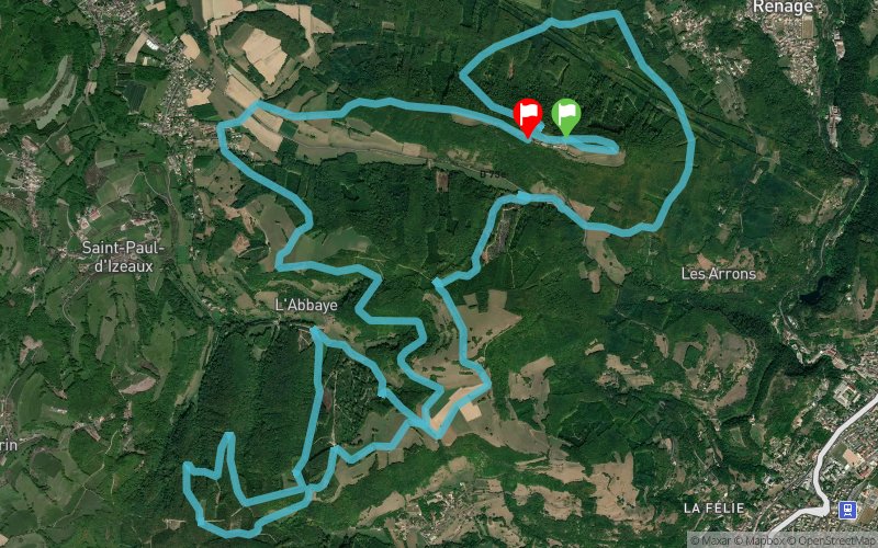


21.1 km
1004 m
1009 m
 Renage (38)
 Renage (38)
 Points of Interest table
| Accum. | Intermediary | |||||||
|---|---|---|---|---|---|---|---|---|
| POI | Description | Alt. | Dist. | D+ | D- | Dist. | D+ | D- |
Trace n°2033
Ascent threshold : 0 m Distance threshold : 35 m Smoothing : Yes Origin of altitudes : MNT Aster GDEM
Ascent threshold : 0 m Distance threshold : 35 m Smoothing : Yes Origin of altitudes : MNT Aster GDEM
Loop
Dominant terrain : Path
Max alti. : 752 m
Avg alti. : 637 m
Min alti. : 463 m
Longest ascent : 238 m
Longest descent : 262 m
Route completed by the author : nc
Dominant terrain : Path
Max alti. : 752 m
Avg alti. : 637 m
Min alti. : 463 m
Longest ascent : 238 m
Longest descent : 262 m
Route completed by the author : nc
Elevation profile
More tools
Create a new roadbook page
Map and track on your website
Warning ! When you insert a Trace de Trail map on your website, you agree not to hide any element of the module (links to Trail Trail or Trail Connect banner)
Add a realisation
Validate
Add a realisation to share your chrono and describe the conditions that you encountered during you trail running !
Add a comment
Validate
cyberblade
10/03/14, 08:40:57
L' organisation annonce 1174 d+ , mon GPS annonce 1000d+
Pensez à garder des forces pour la dernière montée : 1km 300d+
RDV dimanche 16 mars ...
10/03/14, 08:40:57
L' organisation annonce 1174 d+ , mon GPS annonce 1000d+
Pensez à garder des forces pour la dernière montée : 1km 300d+
RDV dimanche 16 mars ...
Show the infos
Add a track


