Show the map
Certified Track - ITRA
Ohm Trail 2016 - Ohm Trail Original
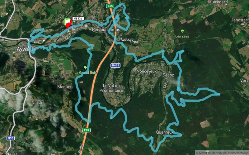


 Aywaille Sougné-Remouchamps (BE)


MORE THAN A TRAIL!
11 ° edition of this now legendary race wanting to be the toughest course in Belgium! Very varied and technical, The Ohm Trail is a true ultra cross nature that you will make discover the beautiful region of Aywaille on a course composed of 90% of forest roads.
DISCOVER LANDSCAPES enchanting ... ALL IN SUFFERING!
The Ohm, the unit of measurement of the resistance effort perfectly symbolizes this trail whose proposed route is fraught with difficulty as, to cite one example, a vertical drop of 1850m D + on the course of 35km, which is a record in Belgium. You will alternate technical sections, single tracks, overhead crossings, ascents and descents.
However, making it especially attractive to this event are the tracks used. A magnificent course that takes the trailers through nature preserves, trails comparable to those found in the mountains in France and thus made them discover the splendid wild corners of the Aywaille region as the terribly beautiful valley of Ninglinspo , varied in every sense of the term, playful and full-bodied ... A treat like other places crossed: the Line of Gattes the Quarreux Fund and other enchanting places.
Veritable as hard as beautiful trail, Ohm The trail will make you suffer with a smile!
Points of Interest table
| Accum. | Intermediary | |||||||
|---|---|---|---|---|---|---|---|---|
| POI | Description | Alt. | Dist. | D+ | D- | Dist. | D+ | D- |
 Competition organized on 06/05/2016
Trace n°19735
Ascent threshold : 3 m Distance threshold : 0 m Smoothing : No Origin of altitudes : GPS
Ascent threshold : 3 m Distance threshold : 0 m Smoothing : No Origin of altitudes : GPS
Loop
Dominant terrain : Footpath
Max alti. : 378 m
Avg alti. : 227 m
Min alti. : 126 m
Longest ascent : 210 m
Longest descent : 180 m
Dominant terrain : Footpath
Max alti. : 378 m
Avg alti. : 227 m
Min alti. : 126 m
Longest ascent : 210 m
Longest descent : 180 m
Elevation profile
More tools
Create a new roadbook page
Map and track on your website
Warning ! When you insert a Trace de Trail map on your website, you agree not to hide any element of the module (links to Trail Trail or Trail Connect banner)
Add a realisation
Validate
Add a realisation to share your chrono and describe the conditions that you encountered during you trail running !
Add a comment
Validate
Show the infos
Add a track


