Show the map
OFFICIAL ROUTE
Vuokatti Trail Challenge 2016 - 100 km


 Inconnu (FI)
 Maanselkä (FI)


100km
0-10 km
100 km competition starts from Hiidenportti National Park which is located in Kainuu region of Finland and municipality of Sotkamo. Wilderness sceneries in the start area are totally amazing. First 10 km of the track will lead the runners through the Hiidenportti National Park. The foothpath is all the way quite narrow, but the sceneries are fantastic when the path will guide the runners through the Hiidenportti canyon area and after that ancient forest area. First 10 km are quite easy to run with only few little hills. In this section the route is quite flat.
10-20 km
In this section runners will follow Talonpojan Taival –hiking trail but the path is very small and there is plenty of undergrowth. Terrain is mainly commercial forest with recently planted forests and logging places and is therefore quite slow and heavy to run expesially on the few swamp areas. In the end of this section the bigger hills comes to the picture when runners are closing the Murtovaara service station. Murtovaara house museum area is few hundred years old where runners will still feel the history of the buildings and surroundings.
20-30km
After Murtovaara service station the route will continue to follow Talonpojan Taival –hiking trail to the Peurajärvi area and after that Kiuruvaara hill area and Halmejärvi service station. In this section the path is very small and there is plenty of undergrowth. Terrain is mainly commercial forest with recently planted forests and logging places and is therefore quite slow and heavy to run. Yet, the sceneries are good in this area where you can feel the wilderness around you. Also in this section the bigger hills comes to the picture in the end when runners are closing the Kiuruvaara Hill area. From Kiuruvaara Runners will come down 100 meters of elevation to Halmejärvi service station.
30-100km
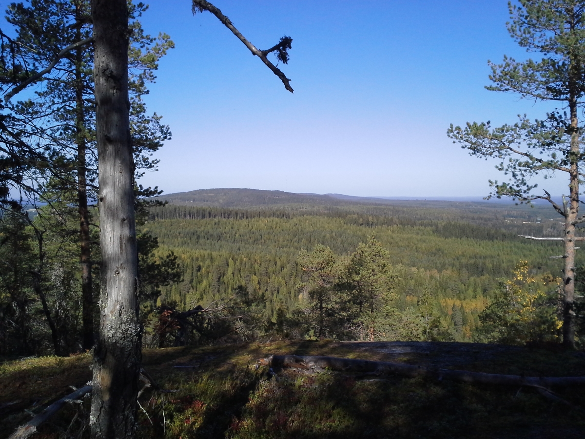
After the Halmejärvi service point the route carries on towards Maanselän Etappi via UKK-hiking track. In this part of the track the runner can admire eq. Tavikoski rapid and magnificent several kilometers long esker on top of which the track runs. Sometimes spectacular viewpoints on top of ridges and forest hills surprise runners. Especially this part of the Vuokatti Trail Challenge radiates the spirit of wilderness and silence of forests where runner can enjoy clean and green nature. From Maanselän Etappi the route continues via 42 km route (see 42 km route description) towards the legendary 13 Hill´s area called Vuokatinvaara which is the great and extremely hard ending to 100 km track. Sceneries are amazing in this Vuokatinvaara area which will start about 23km before finish.
Safety notice: Duckboards and bridges are in some places in a poor shape and should be used with caution as they might break under runner’s weight.
Points of Interest table
| Accum. | Intermediary | |||||||
|---|---|---|---|---|---|---|---|---|
| POI | Description | Alt. | Dist. | D+ | D- | Dist. | D+ | D- |
 Competition organized on 08/20/2016
Trace n°13590
Ascent threshold : 3 m Distance threshold : 0 m Smoothing : No Origin of altitudes : GPS
Ascent threshold : 3 m Distance threshold : 0 m Smoothing : No Origin of altitudes : GPS
Crossing
Dominant terrain : Footpath
Max alti. : 374 m
Avg alti. : 228 m
Min alti. : 127 m
Longest ascent : 160 m
Longest descent : 180 m
Dominant terrain : Footpath
Max alti. : 374 m
Avg alti. : 228 m
Min alti. : 127 m
Longest ascent : 160 m
Longest descent : 180 m
Elevation profile
More tools
Create a new roadbook page
Map and track on your website
Warning ! When you insert a Trace de Trail map on your website, you agree not to hide any element of the module (links to Trail Trail or Trail Connect banner)
Add a realisation
Validate
Add a realisation to share your chrono and describe the conditions that you encountered during you trail running !
Add a comment
Validate
Show the infos
Add a track


