Show the map
Vallée Grand Homme - Mont Ducrocq - les Meuliniers
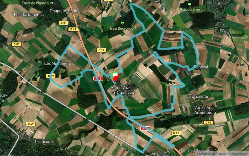


32.2 km
720 m
720 m
 Saint-Vaast-en-Chaussée (80)
 Points of Interest table
| Accum. | Intermediary | |||||||
|---|---|---|---|---|---|---|---|---|
| POI | Description | Alt. | Dist. | D+ | D- | Dist. | D+ | D- |
Trace n°132277
Ascent threshold : 3 m Distance threshold : 30 m Smoothing : Yes Origin of altitudes : MNT Aster GDEM
Ascent threshold : 3 m Distance threshold : 30 m Smoothing : Yes Origin of altitudes : MNT Aster GDEM
Loop
Dominant terrain : Path
Max alti. : 124 m
Avg alti. : 70 m
Min alti. : 19 m
Longest ascent : 80 m
Longest descent : 110 m
Route completed by the author : Yes
Dominant terrain : Path
Max alti. : 124 m
Avg alti. : 70 m
Min alti. : 19 m
Longest ascent : 80 m
Longest descent : 110 m
Route completed by the author : Yes
Elevation profile
More tools
Create a new roadbook page
Map and track on your website
Warning ! When you insert a Trace de Trail map on your website, you agree not to hide any element of the module (links to Trail Trail or Trail Connect banner)
Add a realisation
Validate
Add a realisation to share your chrono and describe the conditions that you encountered during you trail running !
Add a comment
Validate
Marie Chesneau
18/09/22, 20:34:16
parcours majoritairement sur route et sentiers. prévoir des chaussures rouges plutôt que trail !
18/09/22, 20:34:16
parcours majoritairement sur route et sentiers. prévoir des chaussures rouges plutôt que trail !
Show the infos
Add a track


