Le Goutaroux
Add to my favorites


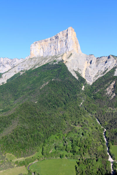
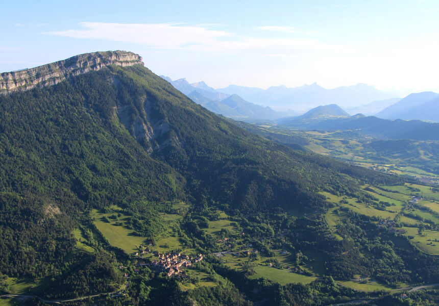
Au départ de Trézanne, cette randonnée vous conduit sur les crêtes des rochers de l'Aubeyron jusqu'au Goutarou. Depuis cette crête vous aurez une vue sur l'ensemble du Trièves et ses sommets : Mont-Aiguille, Massif de l'Obiou, du Chatel …
Route labeled FFRandonnée

The characteristics of the route.

Saint-Martin-de-Clelles (38)
- Distance 8.1 km
- Elevation gain 580 m
- Elevation lost 580 m
- Min. elevation 1011 m
- Max. elevation. 1530 m
- Duration (depending on pace) 3h30
- Marking Yes
Equipments : Car park, Admission fee : Free access.Opening : From 01/04 to 31/10.
Subject to favorable weather.
Area : Trièves
Report a problem Add a comment
Website Pdf file Features of the application :
- Location and orientation on detailed maps thanks to the GPS of your smartphone
- Description of routes and points of interest on the route
- Photo gallery by route
- Detailed elevation profile
- Route tracking alert to warn you if you stray from the route
- Send predefined messages by SMS to your contacts
- Emergency module: trigger a call or send an emergency SMS in case of problem
- Agenda: access to events organized in the department
- News: find in the application the latest news on the web portal
- Adding achievements
- Add reports in case of problems encountered on the routes
- Share on social networks
Add your time and share your feelings
Services nearby

Foyer nordique de Chichilianne
Chichilianne

Point d'information Chichilianne
Chichilianne
Foyer nordique de Gresse-en-Vercors
Gresse-en-Vercors
Bureau d'Informations Touristiques de Gresse en Vercors - Office de Tourisme du Trièves
Gresse-en-Vercors
Point d'information du Môle (Lac de Monteynard-Avignonet)
Treffort


Information updated on 2022-09-01 by Isère Attractivité


Follow us on
the digital trails
the digital trails


![]()
The Isère Outdoor application was created
by the Département de l'Isère
Infos & contact
Conseil départemental de l'Isère
7 rue Fantin Latour
CS 41096
38 022 Grenoble cedex 1
Tel. 04 76 00 38 38


OK
Annuler