Show the map
Ecotrail du Pays de Fayence 2020 - 18 km
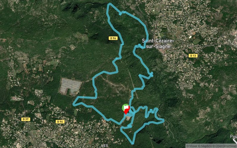


21 km
870 m
870 m
 Montauroux (83)
 Points of Interest table
| Accum. | Intermediary | |||||||
|---|---|---|---|---|---|---|---|---|
| POI | Description | Alt. | Dist. | D+ | D- | Dist. | D+ | D- |
 Competition organized on 09/27/2020
Trace n°105242
Ascent threshold : 3 m Distance threshold : 30 m Smoothing : Yes Origin of altitudes : MNT Aster GDEM
Ascent threshold : 3 m Distance threshold : 30 m Smoothing : Yes Origin of altitudes : MNT Aster GDEM
Loop
Dominant terrain : Footpath
Max alti. : 429 m
Avg alti. : 316 m
Min alti. : 156 m
Longest ascent : 310 m
Longest descent : 250 m
Dominant terrain : Footpath
Max alti. : 429 m
Avg alti. : 316 m
Min alti. : 156 m
Longest ascent : 310 m
Longest descent : 250 m
Elevation profile
More tools
Create a new roadbook page
Map and track on your website
Warning ! When you insert a Trace de Trail map on your website, you agree not to hide any element of the module (links to Trail Trail or Trail Connect banner)
Add a realisation
Validate
Add a realisation to share your chrono and describe the conditions that you encountered during you trail running !
Add a comment
Validate
Fabio83520
20/08/20, 13:44:36
Bonjour , avez vous une trace ou carte de parcours 8,5kms de cet Ecotrail ? Merci
20/08/20, 13:44:36
Bonjour , avez vous une trace ou carte de parcours 8,5kms de cet Ecotrail ? Merci
Show the infos
Add a track


