
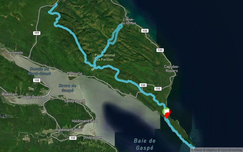
Ultra-Trail® du Bout du Monde 2017 - 110K
 110.3 km
3430 m
3430 m
110.3 km
3430 m
3430 m
23/09/2017
GPX
24
PDF
Profile
Share
3D
Favorites
Reviews
Like
Gaspé (CA) (CA)
Effort kilometer
Longest ascent
Longest descent
144
370 m
460 m
Max. elevation
Min. elevation
Quality index
492 m
0 m
 1pt/22m
TUNNING MOUNTAINS
Ultra-Trail® du Bout du Monde, created in partnership with Parks Canada, is a unique experience that will allow runners of all levels to discover seascapes and breathtaking mountains and unique in Canada.
CREATE BY RUNNERS
Ultra-Trail® du Bout du Monde (UTBdM) was created by the runers on trail. It has been developed by Land’s End Expedition Racing, popular Canadian Festival organizer Skyrunning and the Ultra-Trail® du Mont Albert (UTMA) in Gaspésie National Park. The UTBdM promises to be another great success for the community of trail running, Gaspésie and Quebec.
AUTUMN COLORS
The races take place in the Forillon Peninsula amid the fall colors, and will include courses from 10 to 135 km. Family races of 800 meters and 3 km are also planned for the next generation of runners.
FORILLON PARK
Ultra-Trail® du Bout du Monde was created to showcase the natural beauty and incomparable Forillon National Park and ensure its national and international visibility. The UTBdM continue to cement the Gaspé reputation as new paths of racing Mecca in the eastern provinces of Canada.
En voir plus... En voir moins...

Start
Distance
0 km
Altitude
41 m
D+
0 m
D-
0 m
110.3 km
3430 m
3430 m
Finish
Distance
110.3 km
Altitude
41 m
D+
3430 m
D-
3430 m
Click on a point of interest to display it on the map
Reviews and times
Add a track
Ultra-Trail® du Bout du Monde 2017 - 110K

Track number : 41426
Link to track :
https://tracedetrail.fr/en/trace/41426
Log in to insert this track on your website
 Trace de Trail